E64A Bridgewater, ME, USA - Earthquake Result Viewer
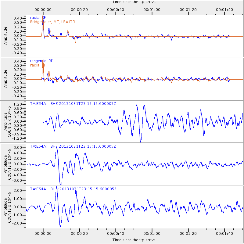
Earthquake location: Near Coast Of Central Chile
Earthquake latitude/longitude: -30.3/-71.5
Earthquake time(UTC): 2013/10/31 (304) 23:03:59 GMT
Earthquake Depth: 27 km
Earthquake Magnitude: 6.6 MWW, 6.4 MWB, 6.5 MWC, 6.6 MWW, 6.6 MI
Earthquake Catalog/Contributor: NEIC PDE/NEIC COMCAT
Network: TA USArray Transportable Network (new EarthScope stations)
Station: E64A Bridgewater, ME, USA
Lat/Lon: 46.42 N/67.83 W
Elevation: 190 m
Distance: 76.4 deg
Az: 2.627 deg
Baz: 183.286 deg
Ray Param: 0.050969776
Estimated Moho Depth: 35.0 km
Estimated Crust Vp/Vs: 1.60
Assumed Crust Vp: 6.419 km/s
Estimated Crust Vs: 4.006 km/s
Estimated Crust Poisson's Ratio: 0.18
Radial Match: 88.384476 %
Radial Bump: 344
Transverse Match: 81.64278 %
Transverse Bump: 400
SOD ConfigId: 626651
Insert Time: 2014-04-19 09:11:05.603 +0000
GWidth: 2.5
Max Bumps: 400
Tol: 0.001

Signal To Noise

ChannelStoNSTALTA
TA:E64A: :BHZ:20131031T23:15:15.600005Z2.8814876.8339085E-72.3716605E-7
TA:E64A: :BHN:20131031T23:15:15.600005Z1.81207884.3283418E-72.3886057E-7
TA:E64A: :BHE:20131031T23:15:15.600005Z0.490702451.04220085E-72.1238957E-7
Arrivals
Ps3.4 SECOND
PpPs14 SECOND
PsPs/PpSs17 SECOND