
F52A Sundridge, ON, CAN - Earthquake Result Viewer
| ||||||||||||||||||
| ||||||||||||||||||
| ||||||||||||||||||
|
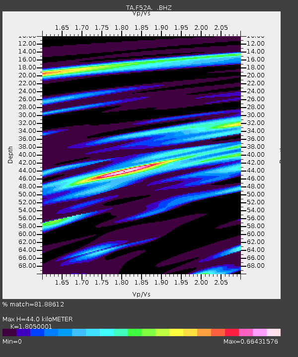
Signal To Noise
| Channel | StoN | STA | LTA |
| TA:F52A: :BHZ:20131031T23:15:13.524016Z | 1.8569402 | 7.2978014E-7 | 3.9300144E-7 |
| TA:F52A: :BHN:20131031T23:15:13.524016Z | 1.8051807 | 5.23247E-7 | 2.8985852E-7 |
| TA:F52A: :BHE:20131031T23:15:13.524016Z | 1.2828786 | 2.7074034E-7 | 2.1104127E-7 |
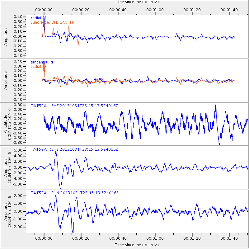
| Arrivals | |
| Ps | 5.6 SECOND |
| PpPs | 18 SECOND |
| PsPs/PpSs | 24 SECOND |

