
G03D McMinnville, OR, USA - Earthquake Result Viewer
| ||||||||||||||||||
| ||||||||||||||||||
| ||||||||||||||||||
|
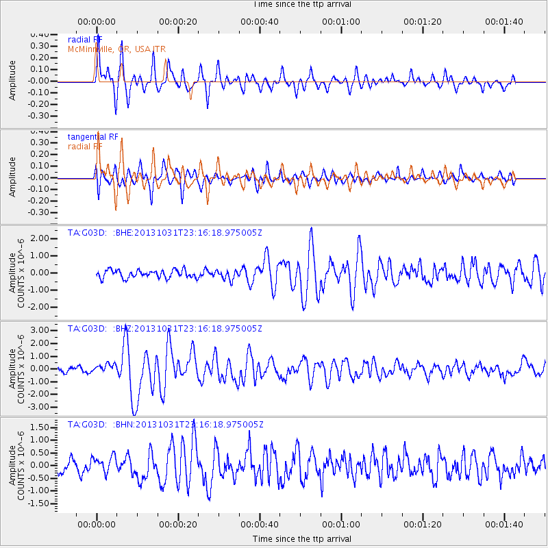
Signal To Noise
| Channel | StoN | STA | LTA |
| TA:G03D: :BHZ:20131031T23:16:18.975005Z | 1.6940571 | 3.7164543E-7 | 2.1938189E-7 |
| TA:G03D: :BHN:20131031T23:16:18.975005Z | 1.2080706 | 3.3986967E-7 | 2.8133263E-7 |
| TA:G03D: :BHE:20131031T23:16:18.975005Z | 1.209157 | 2.772041E-7 | 2.29254E-7 |
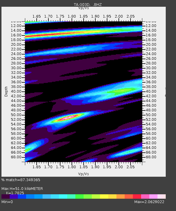
| Arrivals | |
| Ps | 6.2 SECOND |
| PpPs | 21 SECOND |
| PsPs/PpSs | 27 SECOND |

