G47A Hillman, MI, USA - Earthquake Result Viewer
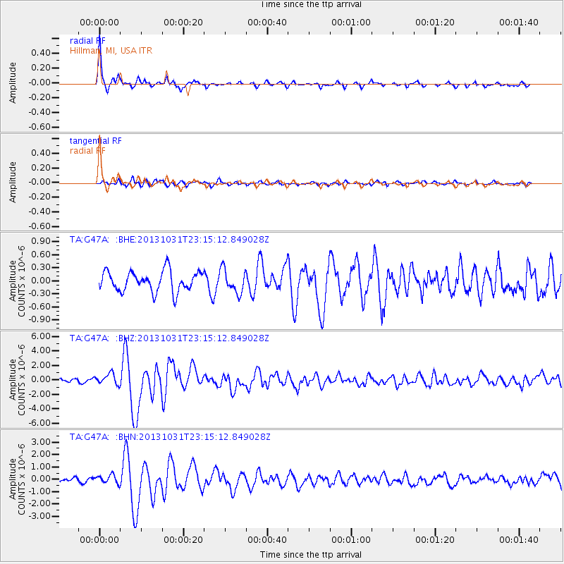
Earthquake location: Near Coast Of Central Chile
Earthquake latitude/longitude: -30.3/-71.5
Earthquake time(UTC): 2013/10/31 (304) 23:03:59 GMT
Earthquake Depth: 27 km
Earthquake Magnitude: 6.6 MWW, 6.4 MWB, 6.5 MWC, 6.6 MWW, 6.6 MI
Earthquake Catalog/Contributor: NEIC PDE/NEIC COMCAT
Network: TA USArray Transportable Network (new EarthScope stations)
Station: G47A Hillman, MI, USA
Lat/Lon: 45.17 N/83.86 W
Elevation: 239 m
Distance: 75.9 deg
Az: 351.039 deg
Baz: 169.02 deg
Ray Param: 0.051295023
Estimated Moho Depth: 20.5 km
Estimated Crust Vp/Vs: 2.04
Assumed Crust Vp: 6.483 km/s
Estimated Crust Vs: 3.186 km/s
Estimated Crust Poisson's Ratio: 0.34
Radial Match: 95.434875 %
Radial Bump: 303
Transverse Match: 70.73578 %
Transverse Bump: 400
SOD ConfigId: 626651
Insert Time: 2014-04-19 09:12:00.198 +0000
GWidth: 2.5
Max Bumps: 400
Tol: 0.001

Signal To Noise

ChannelStoNSTALTA
TA:G47A: :BHZ:20131031T23:15:12.849028Z2.61576637.672383E-72.9331304E-7
TA:G47A: :BHN:20131031T23:15:12.849028Z2.1233283.5450404E-71.669568E-7
TA:G47A: :BHE:20131031T23:15:12.849028Z1.15964582.7299689E-72.3541403E-7
Arrivals
Ps3.4 SECOND
PpPs9.3 SECOND
PsPs/PpSs13 SECOND