
I55A Frankford, ON, CAN - Earthquake Result Viewer
| ||||||||||||||||||
| ||||||||||||||||||
| ||||||||||||||||||
|
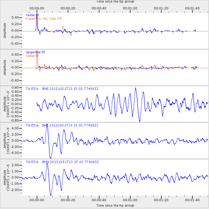
Signal To Noise
| Channel | StoN | STA | LTA |
| TA:I55A: :BHZ:20131031T23:15:03.774993Z | 2.890572 | 7.290172E-7 | 2.5220515E-7 |
| TA:I55A: :BHN:20131031T23:15:03.774993Z | 2.1181128 | 3.8744872E-7 | 1.8292167E-7 |
| TA:I55A: :BHE:20131031T23:15:03.774993Z | 1.0801017 | 1.705667E-7 | 1.5791726E-7 |
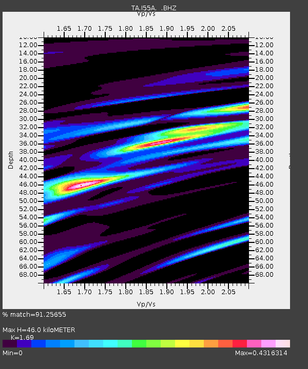
| Arrivals | |
| Ps | 5.0 SECOND |
| PpPs | 18 SECOND |
| PsPs/PpSs | 23 SECOND |

