I58A Old Forge, NY, USA - Earthquake Result Viewer
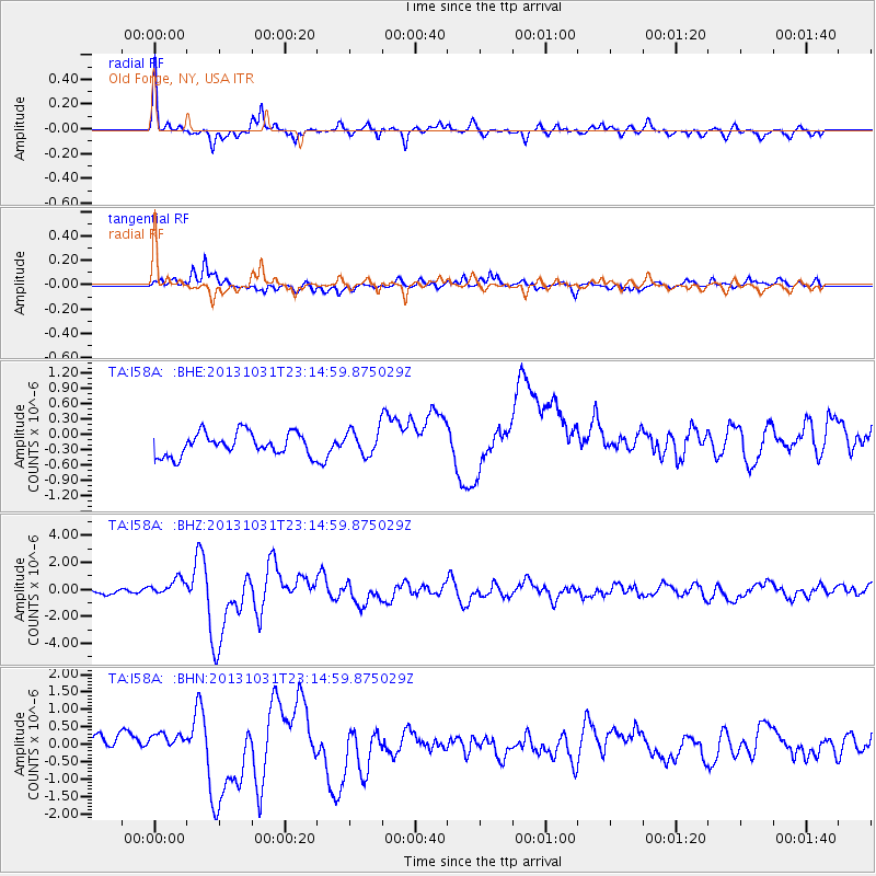
Earthquake location: Near Coast Of Central Chile
Earthquake latitude/longitude: -30.3/-71.5
Earthquake time(UTC): 2013/10/31 (304) 23:03:59 GMT
Earthquake Depth: 27 km
Earthquake Magnitude: 6.6 MWW, 6.4 MWB, 6.5 MWC, 6.6 MWW, 6.6 MI
Earthquake Catalog/Contributor: NEIC PDE/NEIC COMCAT
Network: TA USArray Transportable Network (new EarthScope stations)
Station: I58A Old Forge, NY, USA
Lat/Lon: 43.69 N/74.97 W
Elevation: 599 m
Distance: 73.7 deg
Az: 357.392 deg
Baz: 176.89 deg
Ray Param: 0.05280083
Estimated Moho Depth: 38.75 km
Estimated Crust Vp/Vs: 1.84
Assumed Crust Vp: 6.419 km/s
Estimated Crust Vs: 3.489 km/s
Estimated Crust Poisson's Ratio: 0.29
Radial Match: 85.66875 %
Radial Bump: 358
Transverse Match: 70.48895 %
Transverse Bump: 400
SOD ConfigId: 626651
Insert Time: 2014-04-19 09:13:52.411 +0000
GWidth: 2.5
Max Bumps: 400
Tol: 0.001

Signal To Noise

ChannelStoNSTALTA
TA:I58A: :BHZ:20131031T23:14:59.875029Z2.36082656.387578E-72.7056532E-7
TA:I58A: :BHN:20131031T23:14:59.875029Z0.60659111.7571881E-72.8968248E-7
TA:I58A: :BHE:20131031T23:14:59.875029Z1.12236192.480618E-72.2101769E-7
Arrivals
Ps5.2 SECOND
PpPs17 SECOND
PsPs/PpSs22 SECOND