I64A Boothbay, ME, USA - Earthquake Result Viewer
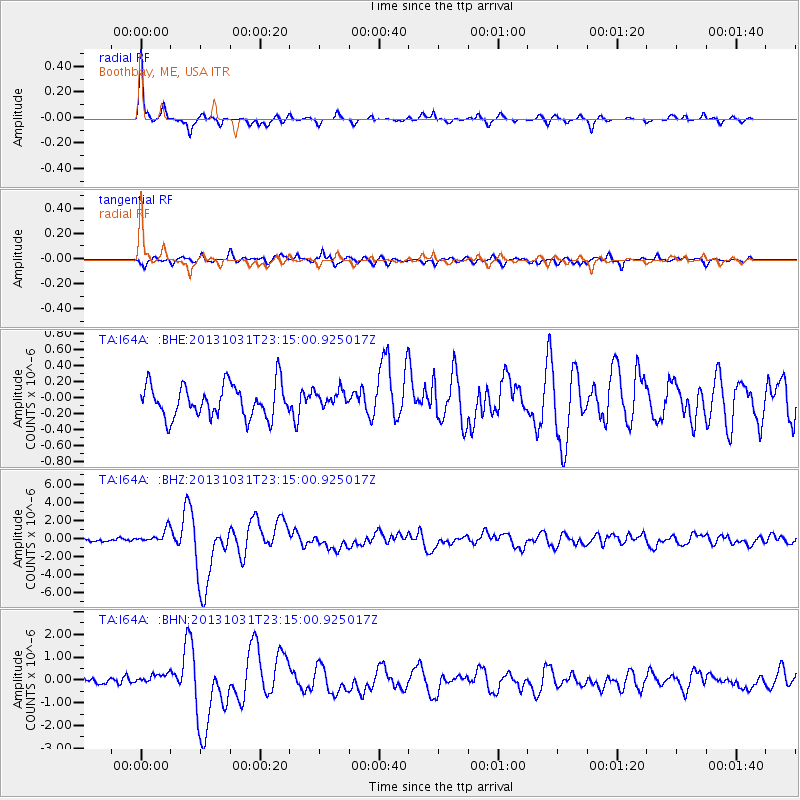
Earthquake location: Near Coast Of Central Chile
Earthquake latitude/longitude: -30.3/-71.5
Earthquake time(UTC): 2013/10/31 (304) 23:03:59 GMT
Earthquake Depth: 27 km
Earthquake Magnitude: 6.6 MWW, 6.4 MWB, 6.5 MWC, 6.6 MWW, 6.6 MI
Earthquake Catalog/Contributor: NEIC PDE/NEIC COMCAT
Network: TA USArray Transportable Network (new EarthScope stations)
Station: I64A Boothbay, ME, USA
Lat/Lon: 43.92 N/69.63 W
Elevation: 17 m
Distance: 73.9 deg
Az: 1.419 deg
Baz: 181.699 deg
Ray Param: 0.052678708
Estimated Moho Depth: 35.25 km
Estimated Crust Vp/Vs: 1.70
Assumed Crust Vp: 6.419 km/s
Estimated Crust Vs: 3.776 km/s
Estimated Crust Poisson's Ratio: 0.24
Radial Match: 93.72418 %
Radial Bump: 255
Transverse Match: 80.631195 %
Transverse Bump: 400
SOD ConfigId: 626651
Insert Time: 2014-04-19 09:14:07.557 +0000
GWidth: 2.5
Max Bumps: 400
Tol: 0.001

Signal To Noise

ChannelStoNSTALTA
TA:I64A: :BHZ:20131031T23:15:00.925017Z3.93982087.6386004E-71.9388192E-7
TA:I64A: :BHN:20131031T23:15:00.925017Z1.84633552.4417685E-71.3224944E-7
TA:I64A: :BHE:20131031T23:15:00.925017Z0.51259791.05223656E-72.0527524E-7
Arrivals
Ps4.0 SECOND
PpPs14 SECOND
PsPs/PpSs18 SECOND