
J45A Montague, MI, USA - Earthquake Result Viewer
| ||||||||||||||||||
| ||||||||||||||||||
| ||||||||||||||||||
|
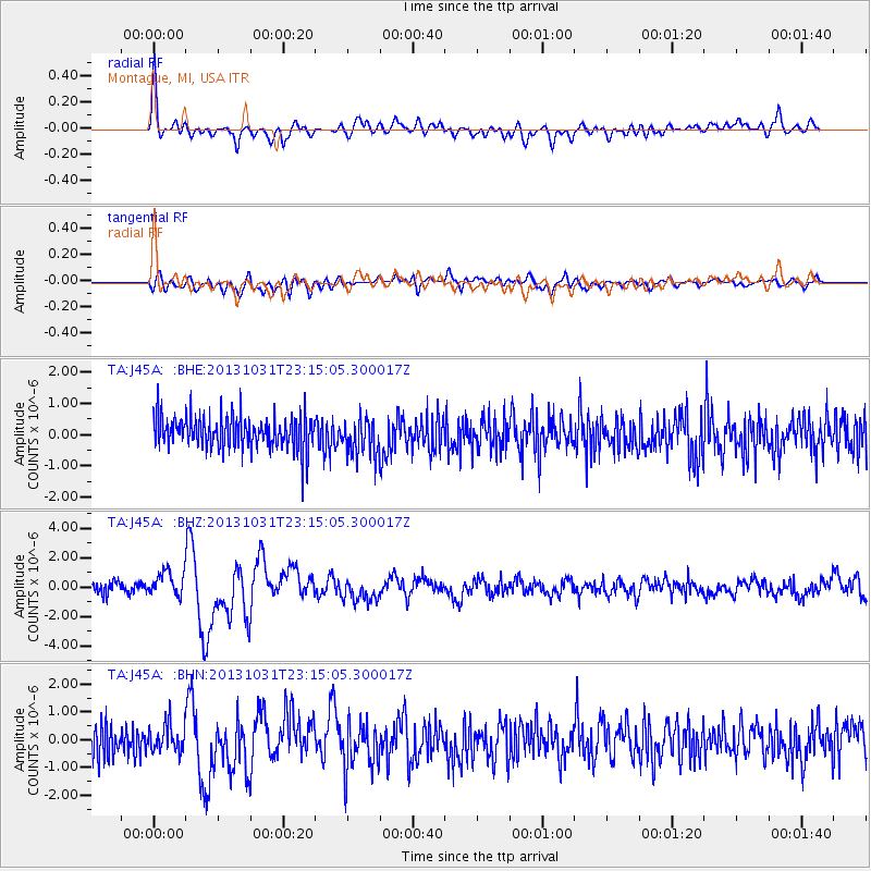
Signal To Noise
| Channel | StoN | STA | LTA |
| TA:J45A: :BHZ:20131031T23:15:05.300017Z | 2.5583808 | 8.296904E-7 | 3.2430293E-7 |
| TA:J45A: :BHN:20131031T23:15:05.300017Z | 1.0323577 | 4.834317E-7 | 4.682792E-7 |
| TA:J45A: :BHE:20131031T23:15:05.300017Z | 1.0988573 | 5.90645E-7 | 5.3750836E-7 |
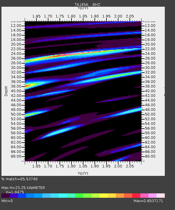
| Arrivals | |
| Ps | 3.1 SECOND |
| PpPs | 9.9 SECOND |
| PsPs/PpSs | 13 SECOND |

