J47A Sunmer, MI, USA - Earthquake Result Viewer
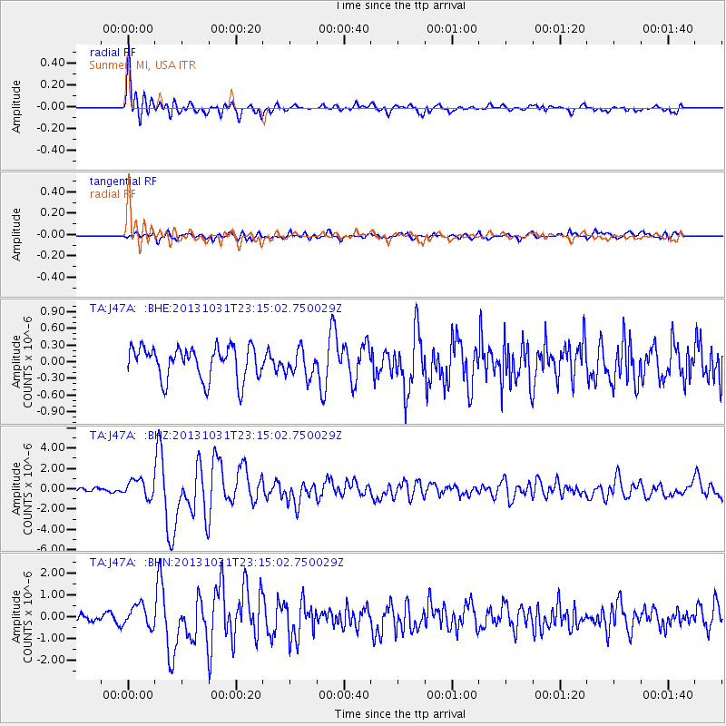
Earthquake location: Near Coast Of Central Chile
Earthquake latitude/longitude: -30.3/-71.5
Earthquake time(UTC): 2013/10/31 (304) 23:03:59 GMT
Earthquake Depth: 27 km
Earthquake Magnitude: 6.6 MWW, 6.4 MWB, 6.5 MWC, 6.6 MWW, 6.6 MI
Earthquake Catalog/Contributor: NEIC PDE/NEIC COMCAT
Network: TA USArray Transportable Network (new EarthScope stations)
Station: J47A Sunmer, MI, USA
Lat/Lon: 43.24 N/84.82 W
Elevation: 236 m
Distance: 74.2 deg
Az: 349.937 deg
Baz: 168.065 deg
Ray Param: 0.05246998
Estimated Moho Depth: 29.25 km
Estimated Crust Vp/Vs: 1.66
Assumed Crust Vp: 6.483 km/s
Estimated Crust Vs: 3.899 km/s
Estimated Crust Poisson's Ratio: 0.22
Radial Match: 91.717995 %
Radial Bump: 400
Transverse Match: 62.464516 %
Transverse Bump: 400
SOD ConfigId: 626651
Insert Time: 2014-04-19 09:14:22.513 +0000
GWidth: 2.5
Max Bumps: 400
Tol: 0.001

Signal To Noise

ChannelStoNSTALTA
TA:J47A: :BHZ:20131031T23:15:02.750029Z3.20751298.745369E-72.7265264E-7
TA:J47A: :BHN:20131031T23:15:02.750029Z2.5102135.004032E-71.9934693E-7
TA:J47A: :BHE:20131031T23:15:02.750029Z0.821358442.409198E-72.9331872E-7
Arrivals
Ps3.1 SECOND
PpPs12 SECOND
PsPs/PpSs15 SECOND