J49A Marlette, MI, USA - Earthquake Result Viewer
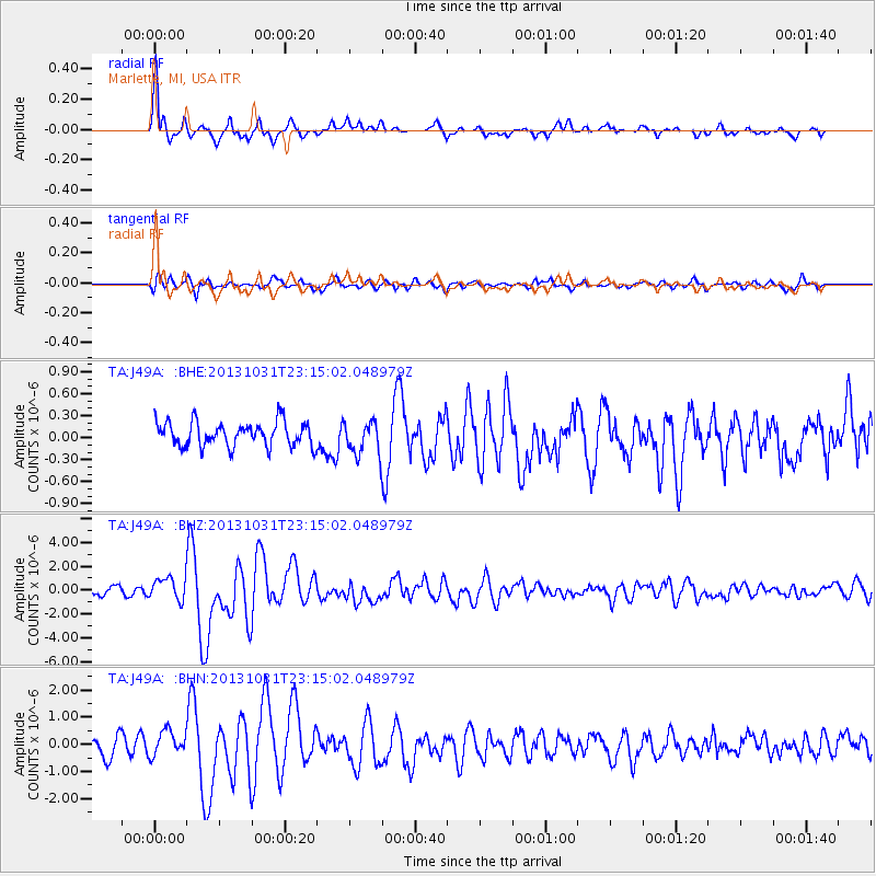
Earthquake location: Near Coast Of Central Chile
Earthquake latitude/longitude: -30.3/-71.5
Earthquake time(UTC): 2013/10/31 (304) 23:03:59 GMT
Earthquake Depth: 27 km
Earthquake Magnitude: 6.6 MWW, 6.4 MWB, 6.5 MWC, 6.6 MWW, 6.6 MI
Earthquake Catalog/Contributor: NEIC PDE/NEIC COMCAT
Network: TA USArray Transportable Network (new EarthScope stations)
Station: J49A Marlette, MI, USA
Lat/Lon: 43.36 N/83.14 W
Elevation: 253 m
Distance: 74.1 deg
Az: 351.214 deg
Baz: 169.564 deg
Ray Param: 0.052549835
Estimated Moho Depth: 11.25 km
Estimated Crust Vp/Vs: 1.78
Assumed Crust Vp: 6.483 km/s
Estimated Crust Vs: 3.647 km/s
Estimated Crust Poisson's Ratio: 0.27
Radial Match: 87.30223 %
Radial Bump: 400
Transverse Match: 75.00732 %
Transverse Bump: 400
SOD ConfigId: 626651
Insert Time: 2014-04-19 09:14:27.861 +0000
GWidth: 2.5
Max Bumps: 400
Tol: 0.001

Signal To Noise

ChannelStoNSTALTA
TA:J49A: :BHZ:20131031T23:15:02.048979Z2.9167819.603937E-73.292649E-7
TA:J49A: :BHN:20131031T23:15:02.048979Z1.47372085.371325E-73.6447372E-7
TA:J49A: :BHE:20131031T23:15:02.048979Z1.40702322.3289469E-71.6552299E-7
Arrivals
Ps1.4 SECOND
PpPs4.7 SECOND
PsPs/PpSs6.1 SECOND