
J57A Williamstown, NY, USA - Earthquake Result Viewer
| ||||||||||||||||||
| ||||||||||||||||||
| ||||||||||||||||||
|
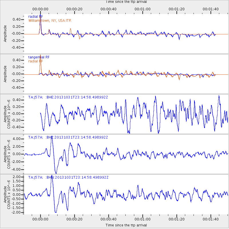
Signal To Noise
| Channel | StoN | STA | LTA |
| TA:J57A: :BHZ:20131031T23:14:58.498992Z | 3.1181107 | 6.771378E-7 | 2.1716285E-7 |
| TA:J57A: :BHN:20131031T23:14:58.498992Z | 1.9461648 | 4.208825E-7 | 2.1626252E-7 |
| TA:J57A: :BHE:20131031T23:14:58.498992Z | 0.9214967 | 1.572243E-7 | 1.7061842E-7 |
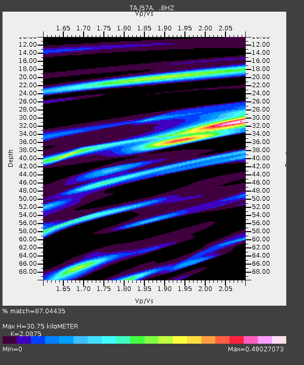
| Arrivals | |
| Ps | 5.4 SECOND |
| PpPs | 14 SECOND |
| PsPs/PpSs | 20 SECOND |

