K22A Casper, WY, USA - Earthquake Result Viewer
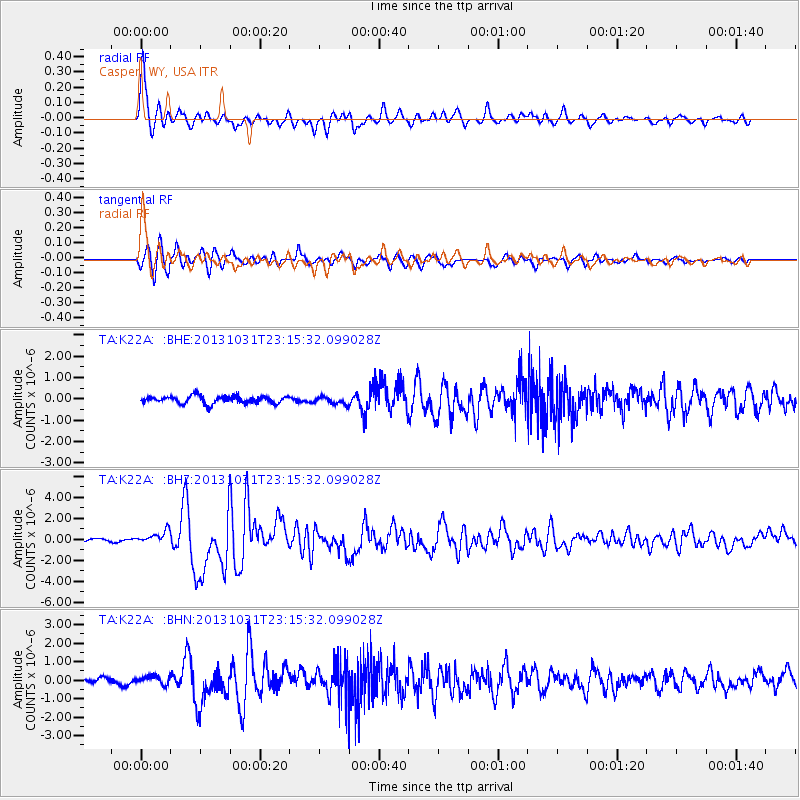
Earthquake location: Near Coast Of Central Chile
Earthquake latitude/longitude: -30.3/-71.5
Earthquake time(UTC): 2013/10/31 (304) 23:03:59 GMT
Earthquake Depth: 27 km
Earthquake Magnitude: 6.6 MWW, 6.4 MWB, 6.5 MWC, 6.6 MWW, 6.6 MI
Earthquake Catalog/Contributor: NEIC PDE/NEIC COMCAT
Network: TA USArray Transportable Network (new EarthScope stations)
Station: K22A Casper, WY, USA
Lat/Lon: 42.65 N/106.52 W
Elevation: 1686 m
Distance: 79.4 deg
Az: 334.499 deg
Baz: 149.686 deg
Ray Param: 0.048951633
Estimated Moho Depth: 59.5 km
Estimated Crust Vp/Vs: 1.65
Assumed Crust Vp: 6.178 km/s
Estimated Crust Vs: 3.739 km/s
Estimated Crust Poisson's Ratio: 0.21
Radial Match: 90.617714 %
Radial Bump: 393
Transverse Match: 88.28497 %
Transverse Bump: 400
SOD ConfigId: 626651
Insert Time: 2014-04-19 09:15:00.438 +0000
GWidth: 2.5
Max Bumps: 400
Tol: 0.001

Signal To Noise

ChannelStoNSTALTA
TA:K22A: :BHZ:20131031T23:15:32.099028Z4.08627465.9461445E-71.4551505E-7
TA:K22A: :BHN:20131031T23:15:32.099028Z1.3504872.2573256E-71.67149E-7
TA:K22A: :BHE:20131031T23:15:32.099028Z0.98991951.7155692E-71.7330392E-7
Arrivals
Ps6.5 SECOND
PpPs25 SECOND
PsPs/PpSs31 SECOND