K49A Clarkson, MI, USA - Earthquake Result Viewer
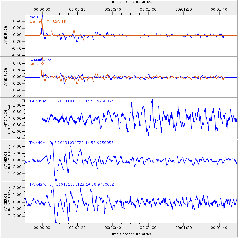
Earthquake location: Near Coast Of Central Chile
Earthquake latitude/longitude: -30.3/-71.5
Earthquake time(UTC): 2013/10/31 (304) 23:03:59 GMT
Earthquake Depth: 27 km
Earthquake Magnitude: 6.6 MWW, 6.4 MWB, 6.5 MWC, 6.6 MWW, 6.6 MI
Earthquake Catalog/Contributor: NEIC PDE/NEIC COMCAT
Network: TA USArray Transportable Network (new EarthScope stations)
Station: K49A Clarkson, MI, USA
Lat/Lon: 42.78 N/83.46 W
Elevation: 336 m
Distance: 73.5 deg
Az: 350.866 deg
Baz: 169.251 deg
Ray Param: 0.052900907
Estimated Moho Depth: 50.25 km
Estimated Crust Vp/Vs: 1.91
Assumed Crust Vp: 6.483 km/s
Estimated Crust Vs: 3.394 km/s
Estimated Crust Poisson's Ratio: 0.31
Radial Match: 87.61756 %
Radial Bump: 400
Transverse Match: 82.89627 %
Transverse Bump: 400
SOD ConfigId: 626651
Insert Time: 2014-04-19 09:15:13.899 +0000
GWidth: 2.5
Max Bumps: 400
Tol: 0.001

Signal To Noise

ChannelStoNSTALTA
TA:K49A: :BHZ:20131031T23:14:58.975005Z2.3340077.7494695E-73.3202426E-7
TA:K49A: :BHN:20131031T23:14:58.975005Z1.50856834.3680848E-72.8955168E-7
TA:K49A: :BHE:20131031T23:14:58.975005Z1.43805372.9006682E-72.0170792E-7
Arrivals
Ps7.3 SECOND
PpPs22 SECOND
PsPs/PpSs29 SECOND