K55A Perry, NY, USA - Earthquake Result Viewer
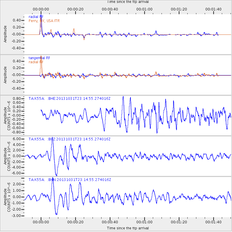
Earthquake location: Near Coast Of Central Chile
Earthquake latitude/longitude: -30.3/-71.5
Earthquake time(UTC): 2013/10/31 (304) 23:03:59 GMT
Earthquake Depth: 27 km
Earthquake Magnitude: 6.6 MWW, 6.4 MWB, 6.5 MWC, 6.6 MWW, 6.6 MI
Earthquake Catalog/Contributor: NEIC PDE/NEIC COMCAT
Network: TA USArray Transportable Network (new EarthScope stations)
Station: K55A Perry, NY, USA
Lat/Lon: 42.73 N/78.07 W
Elevation: 482 m
Distance: 72.9 deg
Az: 354.957 deg
Baz: 174.077 deg
Ray Param: 0.053315956
Estimated Moho Depth: 44.5 km
Estimated Crust Vp/Vs: 1.85
Assumed Crust Vp: 6.419 km/s
Estimated Crust Vs: 3.47 km/s
Estimated Crust Poisson's Ratio: 0.29
Radial Match: 92.683655 %
Radial Bump: 298
Transverse Match: 74.04107 %
Transverse Bump: 400
SOD ConfigId: 626651
Insert Time: 2014-04-19 09:15:26.084 +0000
GWidth: 2.5
Max Bumps: 400
Tol: 0.001

Signal To Noise

ChannelStoNSTALTA
TA:K55A: :BHZ:20131031T23:14:55.274016Z2.92602638.737322E-72.986071E-7
TA:K55A: :BHN:20131031T23:14:55.274016Z1.91174023.6903958E-71.9303856E-7
TA:K55A: :BHE:20131031T23:14:55.274016Z0.820966841.2666435E-71.542868E-7
Arrivals
Ps6.1 SECOND
PpPs19 SECOND
PsPs/PpSs25 SECOND