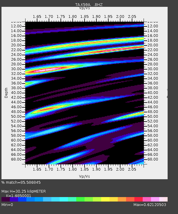
K59A Cooperstown, NY, USA - Earthquake Result Viewer

Earthquake location: Near Coast Of Central Chile
Earthquake latitude/longitude: -30.3/-71.5
Earthquake time(UTC): 2013/10/31 (304) 23:03:59 GMT
Earthquake Depth: 27 km
Earthquake Magnitude: 6.6 MWW, 6.4 MWB, 6.5 MWC, 6.6 MWW, 6.6 MI
Earthquake Catalog/Contributor: NEIC PDE/NEIC COMCAT
Network: TA USArray Transportable Network (new EarthScope stations)
Station: K59A Cooperstown, NY, USA
Lat/Lon: 42.78 N/74.85 W
Elevation: 570 m
Distance: 72.8 deg
Az: 357.433 deg
Baz: 176.984 deg
Ray Param: 0.053406093
Estimated Moho Depth: 30.25 km
Estimated Crust Vp/Vs: 1.69
Assumed Crust Vp: 6.419 km/s
Estimated Crust Vs: 3.81 km/s
Estimated Crust Poisson's Ratio: 0.23
Radial Match: 85.586845 %
Radial Bump: 400
Transverse Match: 72.77988 %
Transverse Bump: 400
SOD ConfigId: 626651
Insert Time: 2014-04-19 09:15:36.600 +0000
GWidth: 2.5
Max Bumps: 400
Tol: 0.001

Signal To Noise

ChannelStoNSTALTA
TA:K59A: :BHZ:20131031T23:14:54.44998Z3.0428987.110838E-72.3368641E-7
TA:K59A: :BHN:20131031T23:14:54.44998Z1.47714953.3548199E-72.2711444E-7
TA:K59A: :BHE:20131031T23:14:54.44998Z0.8405761.7249643E-72.0521217E-7
Arrivals
Ps3.3 SECOND
PpPs12 SECOND
PsPs/PpSs16 SECOND