K63A Dunstable, MA, USA - Earthquake Result Viewer
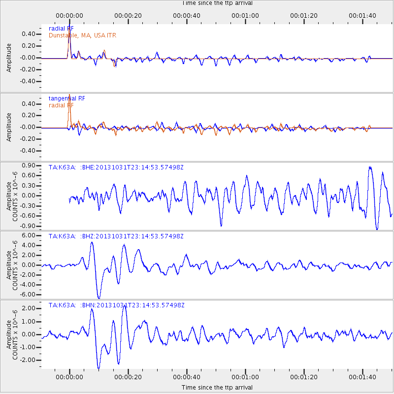
Earthquake location: Near Coast Of Central Chile
Earthquake latitude/longitude: -30.3/-71.5
Earthquake time(UTC): 2013/10/31 (304) 23:03:59 GMT
Earthquake Depth: 27 km
Earthquake Magnitude: 6.6 MWW, 6.4 MWB, 6.5 MWC, 6.6 MWW, 6.6 MI
Earthquake Catalog/Contributor: NEIC PDE/NEIC COMCAT
Network: TA USArray Transportable Network (new EarthScope stations)
Station: K63A Dunstable, MA, USA
Lat/Lon: 42.69 N/71.53 W
Elevation: 68 m
Distance: 72.6 deg
Az: 359.995 deg
Baz: 179.994 deg
Ray Param: 0.053504776
Estimated Moho Depth: 25.5 km
Estimated Crust Vp/Vs: 2.05
Assumed Crust Vp: 6.419 km/s
Estimated Crust Vs: 3.139 km/s
Estimated Crust Poisson's Ratio: 0.34
Radial Match: 94.1087 %
Radial Bump: 337
Transverse Match: 79.83914 %
Transverse Bump: 400
SOD ConfigId: 626651
Insert Time: 2014-04-19 09:15:46.971 +0000
GWidth: 2.5
Max Bumps: 400
Tol: 0.001

Signal To Noise

ChannelStoNSTALTA
TA:K63A: :BHZ:20131031T23:14:53.57498Z2.73533927.582067E-72.7718926E-7
TA:K63A: :BHN:20131031T23:14:53.57498Z2.09057473.2089585E-71.5349647E-7
TA:K63A: :BHE:20131031T23:14:53.57498Z1.00768041.7114242E-71.69838E-7
Arrivals
Ps4.3 SECOND
PpPs12 SECOND
PsPs/PpSs16 SECOND