L46A Eue Claire, MI, USA - Earthquake Result Viewer
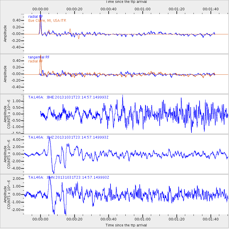
Earthquake location: Near Coast Of Central Chile
Earthquake latitude/longitude: -30.3/-71.5
Earthquake time(UTC): 2013/10/31 (304) 23:03:59 GMT
Earthquake Depth: 27 km
Earthquake Magnitude: 6.6 MWW, 6.4 MWB, 6.5 MWC, 6.6 MWW, 6.6 MI
Earthquake Catalog/Contributor: NEIC PDE/NEIC COMCAT
Network: TA USArray Transportable Network (new EarthScope stations)
Station: L46A Eue Claire, MI, USA
Lat/Lon: 42.01 N/86.30 W
Elevation: 223 m
Distance: 73.2 deg
Az: 348.552 deg
Baz: 166.681 deg
Ray Param: 0.053109284
Estimated Moho Depth: 34.5 km
Estimated Crust Vp/Vs: 1.80
Assumed Crust Vp: 6.483 km/s
Estimated Crust Vs: 3.601 km/s
Estimated Crust Poisson's Ratio: 0.28
Radial Match: 86.59881 %
Radial Bump: 396
Transverse Match: 72.42003 %
Transverse Bump: 400
SOD ConfigId: 626651
Insert Time: 2014-04-19 09:16:04.390 +0000
GWidth: 2.5
Max Bumps: 400
Tol: 0.001

Signal To Noise

ChannelStoNSTALTA
TA:L46A: :BHZ:20131031T23:14:57.149993Z2.8686648.891299E-73.0994565E-7
TA:L46A: :BHN:20131031T23:14:57.149993Z1.55230983.5430043E-72.282408E-7
TA:L46A: :BHE:20131031T23:14:57.149993Z0.739428942.0202438E-72.7321678E-7
Arrivals
Ps4.4 SECOND
PpPs14 SECOND
PsPs/PpSs19 SECOND