
L50A Kingsville, ON, CAN - Earthquake Result Viewer
| ||||||||||||||||||
| ||||||||||||||||||
| ||||||||||||||||||
|
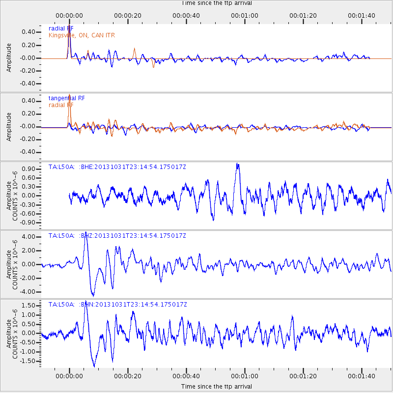
Signal To Noise
| Channel | StoN | STA | LTA |
| TA:L50A: :BHZ:20131031T23:14:54.175017Z | 3.2505221 | 6.0016185E-7 | 1.8463552E-7 |
| TA:L50A: :BHN:20131031T23:14:54.175017Z | 1.400366 | 2.439288E-7 | 1.7418934E-7 |
| TA:L50A: :BHE:20131031T23:14:54.175017Z | 0.8420885 | 1.3102506E-7 | 1.5559534E-7 |
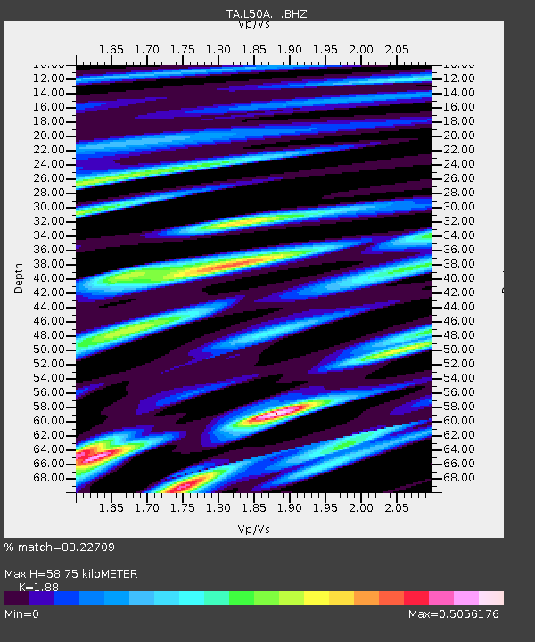
| Arrivals | |
| Ps | 8.2 SECOND |
| PpPs | 25 SECOND |
| PsPs/PpSs | 33 SECOND |

