L54A Sinclairville, NY, USA - Earthquake Result Viewer
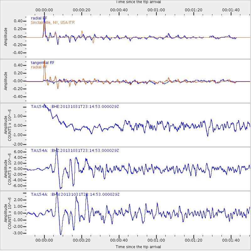
Earthquake location: Near Coast Of Central Chile
Earthquake latitude/longitude: -30.3/-71.5
Earthquake time(UTC): 2013/10/31 (304) 23:03:59 GMT
Earthquake Depth: 27 km
Earthquake Magnitude: 6.6 MWW, 6.4 MWB, 6.5 MWC, 6.6 MWW, 6.6 MI
Earthquake Catalog/Contributor: NEIC PDE/NEIC COMCAT
Network: TA USArray Transportable Network (new EarthScope stations)
Station: L54A Sinclairville, NY, USA
Lat/Lon: 42.23 N/79.32 W
Elevation: 432 m
Distance: 72.5 deg
Az: 353.939 deg
Baz: 172.936 deg
Ray Param: 0.0535684
Estimated Moho Depth: 15.5 km
Estimated Crust Vp/Vs: 1.60
Assumed Crust Vp: 6.419 km/s
Estimated Crust Vs: 4.012 km/s
Estimated Crust Poisson's Ratio: 0.18
Radial Match: 91.48727 %
Radial Bump: 351
Transverse Match: 22.075945 %
Transverse Bump: 400
SOD ConfigId: 626651
Insert Time: 2014-04-19 09:16:16.698 +0000
GWidth: 2.5
Max Bumps: 400
Tol: 0.001

Signal To Noise

ChannelStoNSTALTA
TA:L54A: :BHZ:20131031T23:14:53.000029Z4.26757578.2688445E-71.9375975E-7
TA:L54A: :BHN:20131031T23:14:53.000029Z1.04203413.2877287E-73.1551065E-7
TA:L54A: :BHE:20131031T23:14:53.000029Z0.85366116.6719286E-77.8156637E-7
Arrivals
Ps1.5 SECOND
PpPs6.0 SECOND
PsPs/PpSs7.5 SECOND