
L56A Greenwood, NY, USA - Earthquake Result Viewer
| ||||||||||||||||||
| ||||||||||||||||||
| ||||||||||||||||||
|
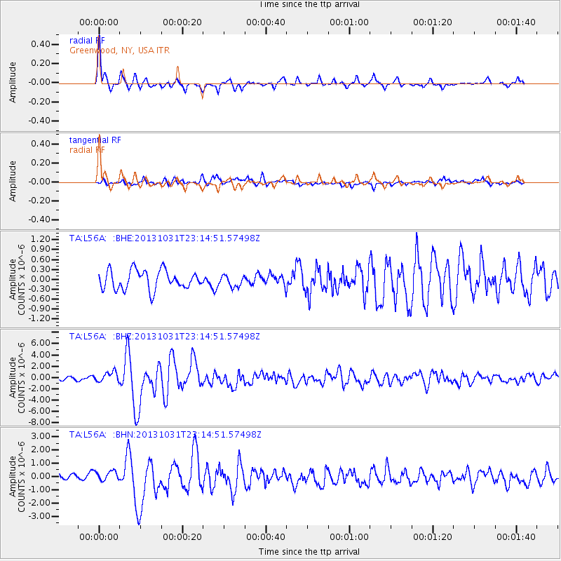
Signal To Noise
| Channel | StoN | STA | LTA |
| TA:L56A: :BHZ:20131031T23:14:51.57498Z | 3.7136147 | 9.288841E-7 | 2.5012937E-7 |
| TA:L56A: :BHN:20131031T23:14:51.57498Z | 1.2173463 | 3.8999818E-7 | 3.203675E-7 |
| TA:L56A: :BHE:20131031T23:14:51.57498Z | 0.6126854 | 1.7334703E-7 | 2.8292993E-7 |
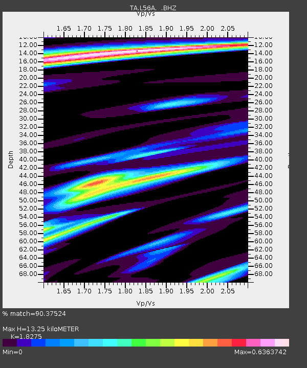
| Arrivals | |
| Ps | 1.8 SECOND |
| PpPs | 5.6 SECOND |
| PsPs/PpSs | 7.3 SECOND |

