
M48A Edgerton, OH, USA - Earthquake Result Viewer
| ||||||||||||||||||
| ||||||||||||||||||
| ||||||||||||||||||
|
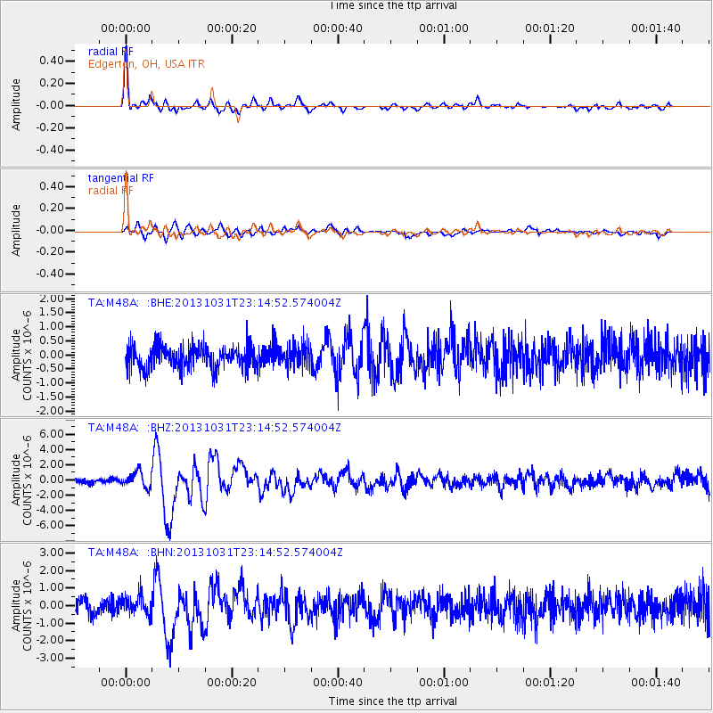
Signal To Noise
| Channel | StoN | STA | LTA |
| TA:M48A: :BHZ:20131031T23:14:52.574004Z | 3.5183988 | 1.013029E-6 | 2.8792329E-7 |
| TA:M48A: :BHN:20131031T23:14:52.574004Z | 1.3982129 | 5.6050004E-7 | 4.0086888E-7 |
| TA:M48A: :BHE:20131031T23:14:52.574004Z | 0.96358585 | 3.9092708E-7 | 4.0570032E-7 |
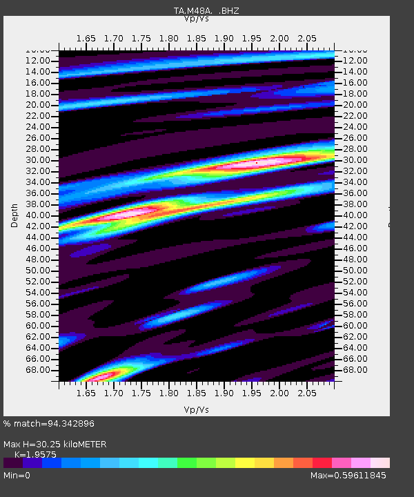
| Arrivals | |
| Ps | 4.6 SECOND |
| PpPs | 13 SECOND |
| PsPs/PpSs | 18 SECOND |

