M51A Elyria, OH, USA - Earthquake Result Viewer
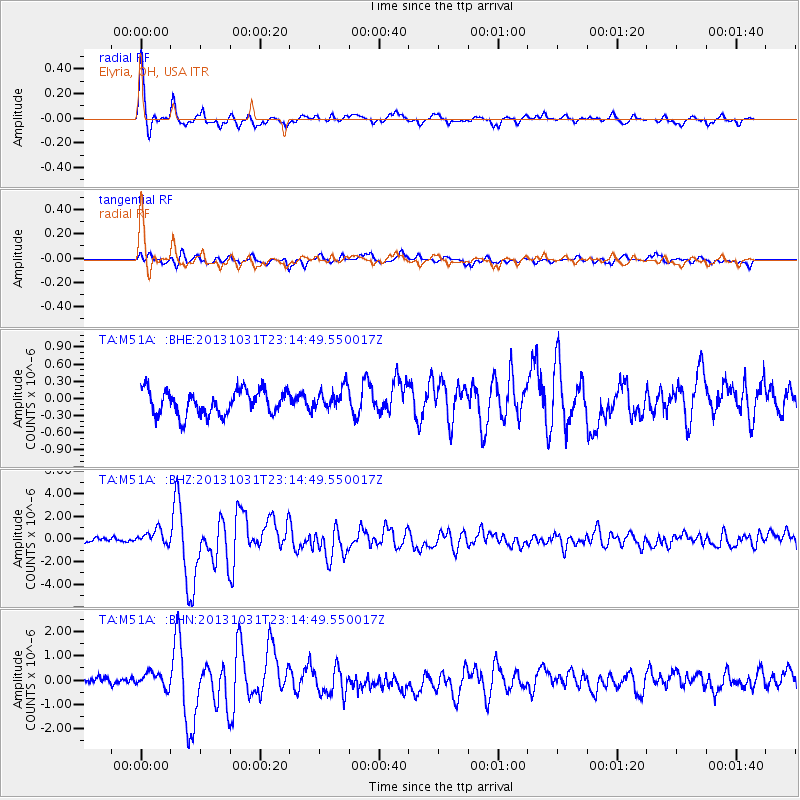
Earthquake location: Near Coast Of Central Chile
Earthquake latitude/longitude: -30.3/-71.5
Earthquake time(UTC): 2013/10/31 (304) 23:03:59 GMT
Earthquake Depth: 27 km
Earthquake Magnitude: 6.6 MWW, 6.4 MWB, 6.5 MWC, 6.6 MWW, 6.6 MI
Earthquake Catalog/Contributor: NEIC PDE/NEIC COMCAT
Network: TA USArray Transportable Network (new EarthScope stations)
Station: M51A Elyria, OH, USA
Lat/Lon: 41.33 N/82.18 W
Elevation: 239 m
Distance: 71.9 deg
Az: 351.573 deg
Baz: 170.311 deg
Ray Param: 0.053953577
Estimated Moho Depth: 34.0 km
Estimated Crust Vp/Vs: 2.02
Assumed Crust Vp: 6.498 km/s
Estimated Crust Vs: 3.221 km/s
Estimated Crust Poisson's Ratio: 0.34
Radial Match: 93.24465 %
Radial Bump: 377
Transverse Match: 78.76806 %
Transverse Bump: 400
SOD ConfigId: 626651
Insert Time: 2014-04-19 09:17:03.543 +0000
GWidth: 2.5
Max Bumps: 400
Tol: 0.001

Signal To Noise

ChannelStoNSTALTA
TA:M51A: :BHZ:20131031T23:14:49.550017Z3.42755276.6143537E-71.92976E-7
TA:M51A: :BHN:20131031T23:14:49.550017Z1.74844153.1985013E-71.8293443E-7
TA:M51A: :BHE:20131031T23:14:49.550017Z0.90099551.9354171E-72.1480874E-7
Arrivals
Ps5.5 SECOND
PpPs15 SECOND
PsPs/PpSs21 SECOND