
MDND Maddock, ND, USA - Earthquake Result Viewer
| ||||||||||||||||||
| ||||||||||||||||||
| ||||||||||||||||||
|
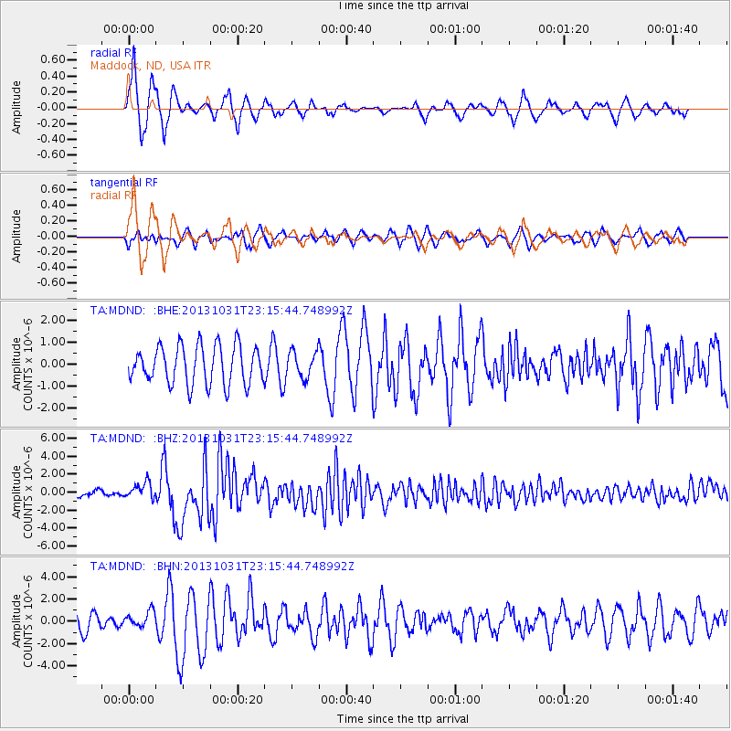
Signal To Noise
| Channel | StoN | STA | LTA |
| TA:MDND: :BHZ:20131031T23:15:44.748992Z | 3.696852 | 9.0091754E-7 | 2.4369857E-7 |
| TA:MDND: :BHN:20131031T23:15:44.748992Z | 0.98678404 | 7.2019907E-7 | 7.2984466E-7 |
| TA:MDND: :BHE:20131031T23:15:44.748992Z | 0.6749108 | 5.904693E-7 | 8.7488496E-7 |
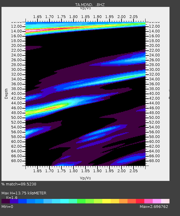
| Arrivals | |
| Ps | 1.3 SECOND |
| PpPs | 5.3 SECOND |
| PsPs/PpSs | 6.6 SECOND |

