
MSTX Muleshoe, TX, USA - Earthquake Result Viewer
| ||||||||||||||||||
| ||||||||||||||||||
| ||||||||||||||||||
|
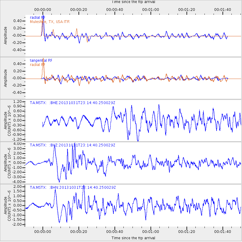
Signal To Noise
| Channel | StoN | STA | LTA |
| TA:MSTX: :BHZ:20131031T23:14:40.250029Z | 2.8607416 | 4.1034176E-7 | 1.4343894E-7 |
| TA:MSTX: :BHN:20131031T23:14:40.250029Z | 1.0138614 | 1.7210306E-7 | 1.697501E-7 |
| TA:MSTX: :BHE:20131031T23:14:40.250029Z | 1.5562282 | 3.1917097E-7 | 2.0509266E-7 |
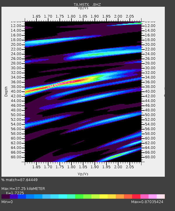
| Arrivals | |
| Ps | 4.5 SECOND |
| PpPs | 16 SECOND |
| PsPs/PpSs | 21 SECOND |

