N02D Trinity Center, CA, USA - Earthquake Result Viewer
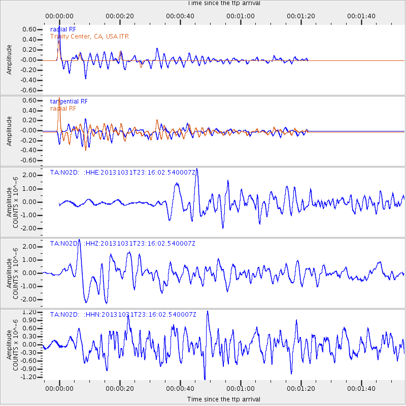
Earthquake location: Near Coast Of Central Chile
Earthquake latitude/longitude: -30.3/-71.5
Earthquake time(UTC): 2013/10/31 (304) 23:03:59 GMT
Earthquake Depth: 27 km
Earthquake Magnitude: 6.6 MWW, 6.4 MWB, 6.5 MWC, 6.6 MWW, 6.6 MI
Earthquake Catalog/Contributor: NEIC PDE/NEIC COMCAT
Network: TA USArray Transportable Network (new EarthScope stations)
Station: N02D Trinity Center, CA, USA
Lat/Lon: 40.97 N/122.71 W
Elevation: 937 m
Distance: 85.3 deg
Az: 323.702 deg
Baz: 137.45 deg
Ray Param: 0.04486289
Estimated Moho Depth: 46.5 km
Estimated Crust Vp/Vs: 1.98
Assumed Crust Vp: 6.566 km/s
Estimated Crust Vs: 3.32 km/s
Estimated Crust Poisson's Ratio: 0.33
Radial Match: 88.328316 %
Radial Bump: 400
Transverse Match: 73.47064 %
Transverse Bump: 400
SOD ConfigId: 626651
Insert Time: 2014-04-19 09:17:44.118 +0000
GWidth: 2.5
Max Bumps: 400
Tol: 0.001

Signal To Noise

ChannelStoNSTALTA
TA:N02D: :HHZ:20131031T23:16:02.540007Z2.94545173.4794928E-71.1813105E-7
TA:N02D: :HHN:20131031T23:16:02.540007Z1.4472351.6073652E-71.1106457E-7
TA:N02D: :HHE:20131031T23:16:02.540007Z0.945165751.2357586E-71.3074516E-7
Arrivals
Ps7.1 SECOND
PpPs21 SECOND
PsPs/PpSs28 SECOND