O50A Cable, OH, USA - Earthquake Result Viewer
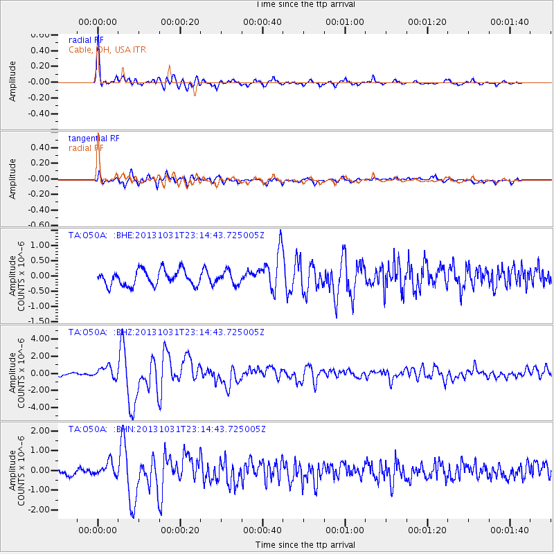
Earthquake location: Near Coast Of Central Chile
Earthquake latitude/longitude: -30.3/-71.5
Earthquake time(UTC): 2013/10/31 (304) 23:03:59 GMT
Earthquake Depth: 27 km
Earthquake Magnitude: 6.6 MWW, 6.4 MWB, 6.5 MWC, 6.6 MWW, 6.6 MI
Earthquake Catalog/Contributor: NEIC PDE/NEIC COMCAT
Network: TA USArray Transportable Network (new EarthScope stations)
Station: O50A Cable, OH, USA
Lat/Lon: 40.15 N/83.62 W
Elevation: 399 m
Distance: 71.0 deg
Az: 350.216 deg
Baz: 168.945 deg
Ray Param: 0.054589678
Estimated Moho Depth: 48.0 km
Estimated Crust Vp/Vs: 1.60
Assumed Crust Vp: 6.498 km/s
Estimated Crust Vs: 4.055 km/s
Estimated Crust Poisson's Ratio: 0.18
Radial Match: 93.00143 %
Radial Bump: 400
Transverse Match: 76.5607 %
Transverse Bump: 400
SOD ConfigId: 626651
Insert Time: 2014-04-19 09:18:39.278 +0000
GWidth: 2.5
Max Bumps: 400
Tol: 0.001

Signal To Noise

ChannelStoNSTALTA
TA:O50A: :BHZ:20131031T23:14:43.725005Z3.567666.886353E-71.9302155E-7
TA:O50A: :BHN:20131031T23:14:43.725005Z1.96543323.6687595E-71.8666417E-7
TA:O50A: :BHE:20131031T23:14:43.725005Z0.84803012.1262245E-72.5072512E-7
Arrivals
Ps4.6 SECOND
PpPs18 SECOND
PsPs/PpSs23 SECOND