
O57A Amberson, PA, USA - Earthquake Result Viewer
| ||||||||||||||||||
| ||||||||||||||||||
| ||||||||||||||||||
|
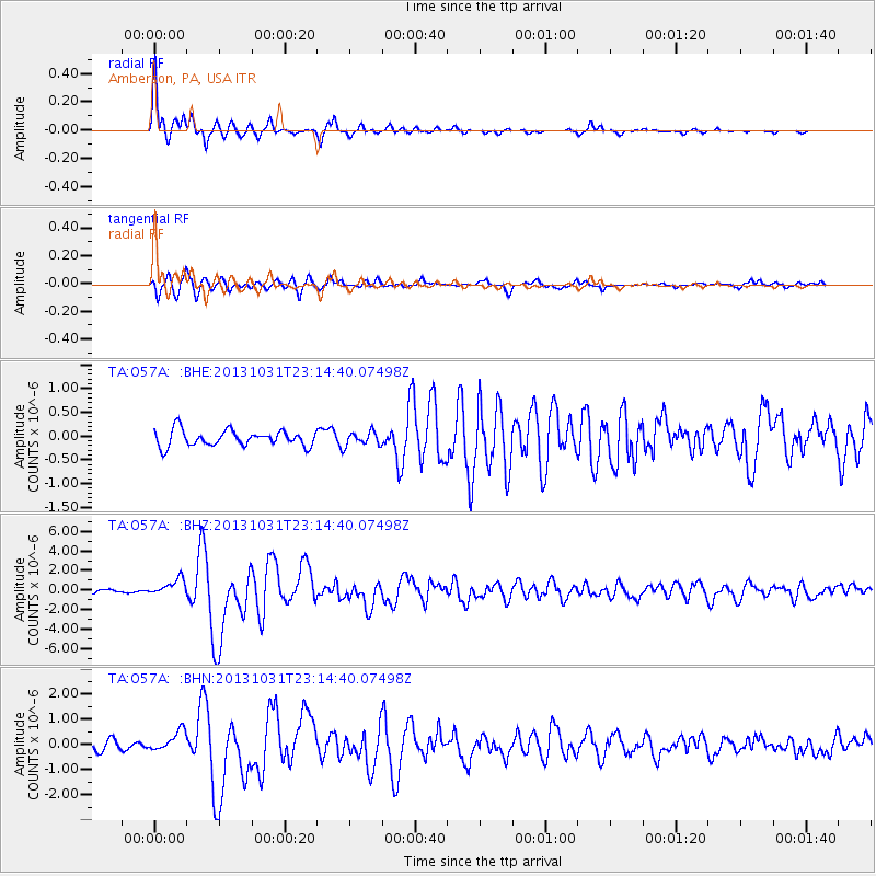
Signal To Noise
| Channel | StoN | STA | LTA |
| TA:O57A: :BHZ:20131031T23:14:40.07498Z | 5.285836 | 8.5207034E-7 | 1.6119877E-7 |
| TA:O57A: :BHN:20131031T23:14:40.07498Z | 2.5584302 | 4.0468856E-7 | 1.5817847E-7 |
| TA:O57A: :BHE:20131031T23:14:40.07498Z | 0.8618893 | 1.432214E-7 | 1.6617145E-7 |
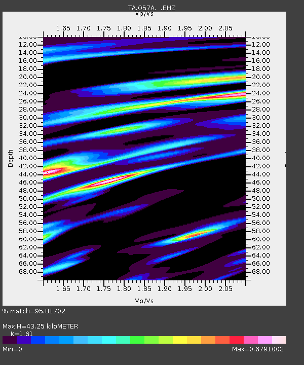
| Arrivals | |
| Ps | 4.5 SECOND |
| PpPs | 18 SECOND |
| PsPs/PpSs | 22 SECOND |

