O60A Telford, PA, USA - Earthquake Result Viewer
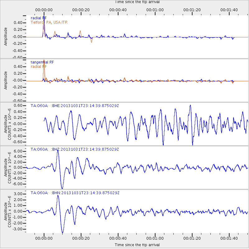
Earthquake location: Near Coast Of Central Chile
Earthquake latitude/longitude: -30.3/-71.5
Earthquake time(UTC): 2013/10/31 (304) 23:03:59 GMT
Earthquake Depth: 27 km
Earthquake Magnitude: 6.6 MWW, 6.4 MWB, 6.5 MWC, 6.6 MWW, 6.6 MI
Earthquake Catalog/Contributor: NEIC PDE/NEIC COMCAT
Network: TA USArray Transportable Network (new EarthScope stations)
Station: O60A Telford, PA, USA
Lat/Lon: 40.32 N/75.40 W
Elevation: 70 m
Distance: 70.3 deg
Az: 356.848 deg
Baz: 176.434 deg
Ray Param: 0.055008303
Estimated Moho Depth: 41.25 km
Estimated Crust Vp/Vs: 2.01
Assumed Crust Vp: 6.283 km/s
Estimated Crust Vs: 3.13 km/s
Estimated Crust Poisson's Ratio: 0.33
Radial Match: 93.862 %
Radial Bump: 249
Transverse Match: 64.347015 %
Transverse Bump: 400
SOD ConfigId: 626651
Insert Time: 2014-04-19 09:19:01.910 +0000
GWidth: 2.5
Max Bumps: 400
Tol: 0.001

Signal To Noise

ChannelStoNSTALTA
TA:O60A: :BHZ:20131031T23:14:39.875029Z2.96316487.574679E-72.55628E-7
TA:O60A: :BHN:20131031T23:14:39.875029Z1.71908383.2841774E-71.9104232E-7
TA:O60A: :BHE:20131031T23:14:39.875029Z0.78605561.6490026E-72.0978192E-7
Arrivals
Ps6.8 SECOND
PpPs19 SECOND
PsPs/PpSs26 SECOND