P46A Rosedale, IN, USA - Earthquake Result Viewer
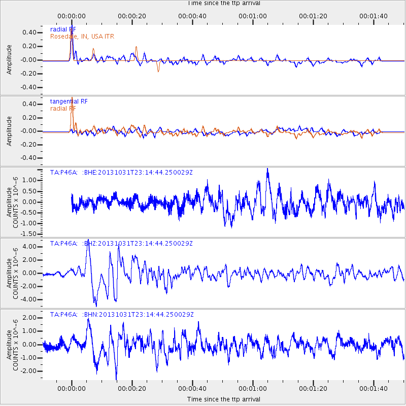
Earthquake location: Near Coast Of Central Chile
Earthquake latitude/longitude: -30.3/-71.5
Earthquake time(UTC): 2013/10/31 (304) 23:03:59 GMT
Earthquake Depth: 27 km
Earthquake Magnitude: 6.6 MWW, 6.4 MWB, 6.5 MWC, 6.6 MWW, 6.6 MI
Earthquake Catalog/Contributor: NEIC PDE/NEIC COMCAT
Network: TA USArray Transportable Network (new EarthScope stations)
Station: P46A Rosedale, IN, USA
Lat/Lon: 39.62 N/87.21 W
Elevation: 194 m
Distance: 71.1 deg
Az: 347.246 deg
Baz: 165.688 deg
Ray Param: 0.05452956
Estimated Moho Depth: 59.5 km
Estimated Crust Vp/Vs: 1.71
Assumed Crust Vp: 6.444 km/s
Estimated Crust Vs: 3.768 km/s
Estimated Crust Poisson's Ratio: 0.24
Radial Match: 90.46501 %
Radial Bump: 400
Transverse Match: 78.06584 %
Transverse Bump: 400
SOD ConfigId: 626651
Insert Time: 2014-04-19 09:19:08.708 +0000
GWidth: 2.5
Max Bumps: 400
Tol: 0.001

Signal To Noise

ChannelStoNSTALTA
TA:P46A: :BHZ:20131031T23:14:44.250029Z3.37178447.2355726E-72.145918E-7
TA:P46A: :BHN:20131031T23:14:44.250029Z1.4887963.637074E-72.4429633E-7
TA:P46A: :BHE:20131031T23:14:44.250029Z1.01233532.0889297E-72.0634762E-7
Arrivals
Ps6.8 SECOND
PpPs24 SECOND
PsPs/PpSs31 SECOND