P54A Burton, WV, USA - Earthquake Result Viewer
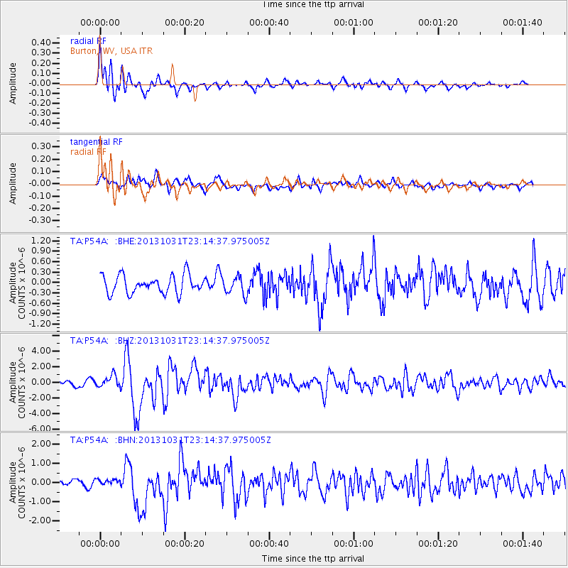
Earthquake location: Near Coast Of Central Chile
Earthquake latitude/longitude: -30.3/-71.5
Earthquake time(UTC): 2013/10/31 (304) 23:03:59 GMT
Earthquake Depth: 27 km
Earthquake Magnitude: 6.6 MWW, 6.4 MWB, 6.5 MWC, 6.6 MWW, 6.6 MI
Earthquake Catalog/Contributor: NEIC PDE/NEIC COMCAT
Network: TA USArray Transportable Network (new EarthScope stations)
Station: P54A Burton, WV, USA
Lat/Lon: 39.61 N/80.48 W
Elevation: 473 m
Distance: 70.0 deg
Az: 352.647 deg
Baz: 171.762 deg
Ray Param: 0.055208728
Estimated Moho Depth: 21.25 km
Estimated Crust Vp/Vs: 1.75
Assumed Crust Vp: 6.207 km/s
Estimated Crust Vs: 3.537 km/s
Estimated Crust Poisson's Ratio: 0.26
Radial Match: 85.433975 %
Radial Bump: 400
Transverse Match: 74.331345 %
Transverse Bump: 400
SOD ConfigId: 626651
Insert Time: 2014-04-19 09:19:25.983 +0000
GWidth: 2.5
Max Bumps: 400
Tol: 0.001

Signal To Noise

ChannelStoNSTALTA
TA:P54A: :BHZ:20131031T23:14:37.975005Z2.447337.7632706E-73.1721387E-7
TA:P54A: :BHN:20131031T23:14:37.975005Z0.463478921.1187401E-72.4137884E-7
TA:P54A: :BHE:20131031T23:14:37.975005Z1.0068982.6014595E-72.5836374E-7
Arrivals
Ps2.7 SECOND
PpPs9.1 SECOND
PsPs/PpSs12 SECOND