P55A Reedsville, WV, USA - Earthquake Result Viewer
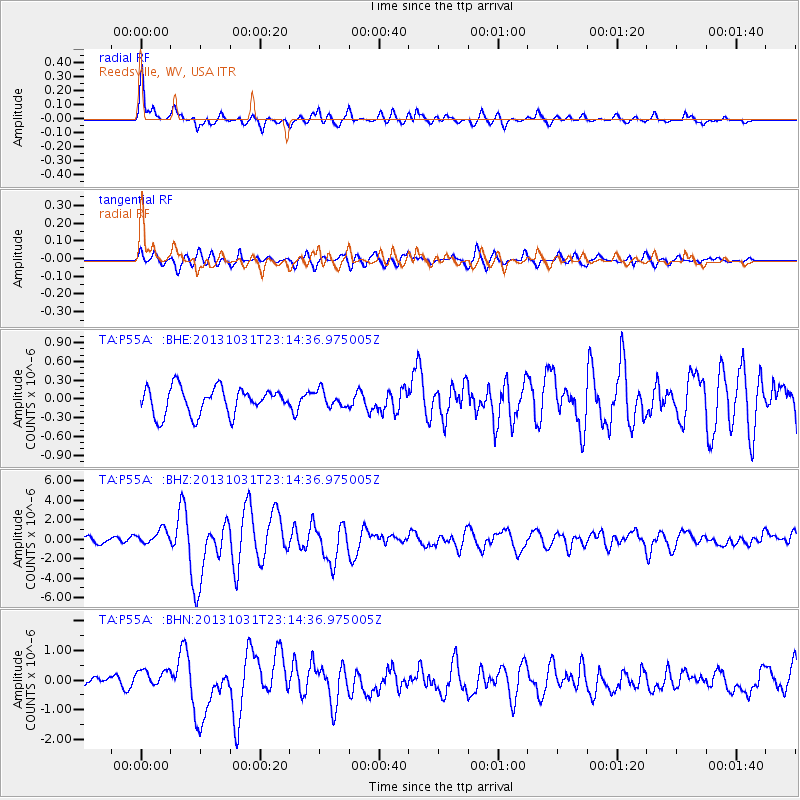
Earthquake location: Near Coast Of Central Chile
Earthquake latitude/longitude: -30.3/-71.5
Earthquake time(UTC): 2013/10/31 (304) 23:03:59 GMT
Earthquake Depth: 27 km
Earthquake Magnitude: 6.6 MWW, 6.4 MWB, 6.5 MWC, 6.6 MWW, 6.6 MI
Earthquake Catalog/Contributor: NEIC PDE/NEIC COMCAT
Network: TA USArray Transportable Network (new EarthScope stations)
Station: P55A Reedsville, WV, USA
Lat/Lon: 39.51 N/79.83 W
Elevation: 551 m
Distance: 69.9 deg
Az: 353.165 deg
Baz: 172.354 deg
Ray Param: 0.05532141
Estimated Moho Depth: 43.25 km
Estimated Crust Vp/Vs: 1.81
Assumed Crust Vp: 6.159 km/s
Estimated Crust Vs: 3.398 km/s
Estimated Crust Poisson's Ratio: 0.28
Radial Match: 88.88081 %
Radial Bump: 400
Transverse Match: 76.15914 %
Transverse Bump: 400
SOD ConfigId: 626651
Insert Time: 2014-04-19 09:19:30.276 +0000
GWidth: 2.5
Max Bumps: 400
Tol: 0.001

Signal To Noise

ChannelStoNSTALTA
TA:P55A: :BHZ:20131031T23:14:36.975005Z3.1233487.5910395E-72.4304174E-7
TA:P55A: :BHN:20131031T23:14:36.975005Z2.2030973.0387278E-71.379298E-7
TA:P55A: :BHE:20131031T23:14:36.975005Z0.60821441.2960359E-72.1308865E-7
Arrivals
Ps5.9 SECOND
PpPs19 SECOND
PsPs/PpSs25 SECOND