
P59A Jarrettsville, MD, USA - Earthquake Result Viewer
| ||||||||||||||||||
| ||||||||||||||||||
| ||||||||||||||||||
|
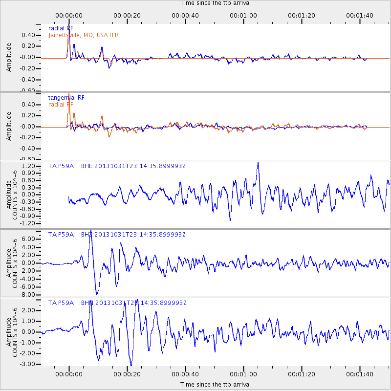
Signal To Noise
| Channel | StoN | STA | LTA |
| TA:P59A: :BHZ:20131031T23:14:35.899993Z | 2.8729582 | 7.995261E-7 | 2.7829367E-7 |
| TA:P59A: :BHN:20131031T23:14:35.899993Z | 2.419156 | 6.377126E-7 | 2.6360954E-7 |
| TA:P59A: :BHE:20131031T23:14:35.899993Z | 1.1717044 | 2.2490649E-7 | 1.9194815E-7 |
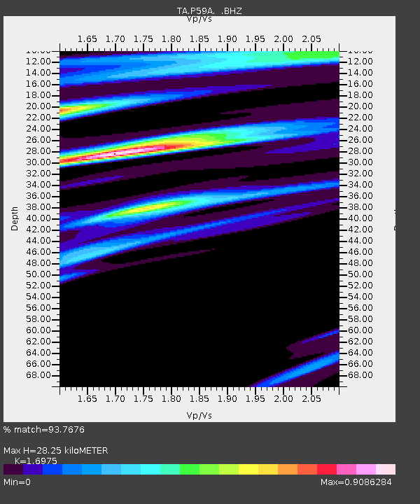
| Arrivals | |
| Ps | 3.2 SECOND |
| PpPs | 11 SECOND |
| PsPs/PpSs | 15 SECOND |

