
Q51A Peebles, OH, USA - Earthquake Result Viewer
| ||||||||||||||||||
| ||||||||||||||||||
| ||||||||||||||||||
|
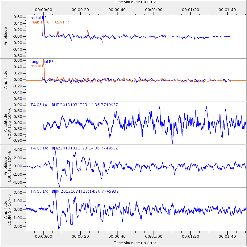
Signal To Noise
| Channel | StoN | STA | LTA |
| TA:Q51A: :BHZ:20131031T23:14:36.774993Z | 4.6685066 | 6.4984624E-7 | 1.391979E-7 |
| TA:Q51A: :BHN:20131031T23:14:36.774993Z | 1.642216 | 3.1920248E-7 | 1.9437303E-7 |
| TA:Q51A: :BHE:20131031T23:14:36.774993Z | 0.7903603 | 1.19179155E-7 | 1.5079092E-7 |
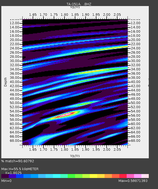
| Arrivals | |
| Ps | 7.4 SECOND |
| PpPs | 24 SECOND |
| PsPs/PpSs | 32 SECOND |

