Q53A Leroy, WV, USA - Earthquake Result Viewer
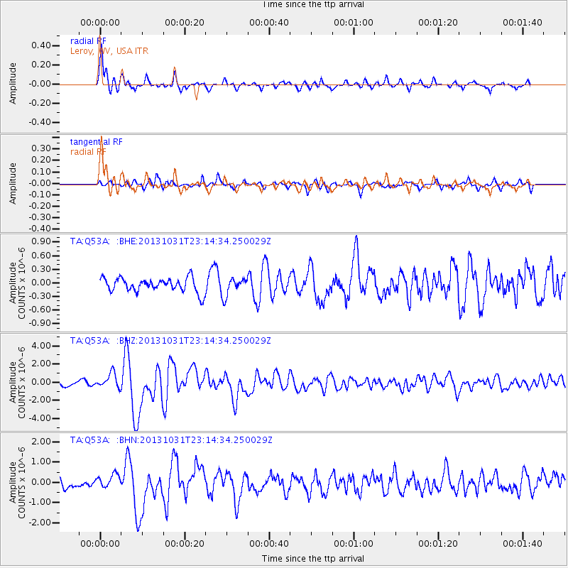
Earthquake location: Near Coast Of Central Chile
Earthquake latitude/longitude: -30.3/-71.5
Earthquake time(UTC): 2013/10/31 (304) 23:03:59 GMT
Earthquake Depth: 27 km
Earthquake Magnitude: 6.6 MWW, 6.4 MWB, 6.5 MWC, 6.6 MWW, 6.6 MI
Earthquake Catalog/Contributor: NEIC PDE/NEIC COMCAT
Network: TA USArray Transportable Network (new EarthScope stations)
Station: Q53A Leroy, WV, USA
Lat/Lon: 38.86 N/81.53 W
Elevation: 310 m
Distance: 69.4 deg
Az: 351.671 deg
Baz: 170.765 deg
Ray Param: 0.055619325
Estimated Moho Depth: 25.75 km
Estimated Crust Vp/Vs: 1.75
Assumed Crust Vp: 6.207 km/s
Estimated Crust Vs: 3.542 km/s
Estimated Crust Poisson's Ratio: 0.26
Radial Match: 90.56269 %
Radial Bump: 393
Transverse Match: 73.86531 %
Transverse Bump: 400
SOD ConfigId: 626651
Insert Time: 2014-04-19 09:20:01.854 +0000
GWidth: 2.5
Max Bumps: 400
Tol: 0.001

Signal To Noise

ChannelStoNSTALTA
TA:Q53A: :BHZ:20131031T23:14:34.250029Z3.24646938.505718E-72.6199902E-7
TA:Q53A: :BHN:20131031T23:14:34.250029Z1.37605373.357687E-72.4400842E-7
TA:Q53A: :BHE:20131031T23:14:34.250029Z1.2670451.9374706E-71.5291252E-7
Arrivals
Ps3.2 SECOND
PpPs11 SECOND
PsPs/PpSs14 SECOND