
Q54A Coxs Mills, WV, USA - Earthquake Result Viewer
| ||||||||||||||||||
| ||||||||||||||||||
| ||||||||||||||||||
|
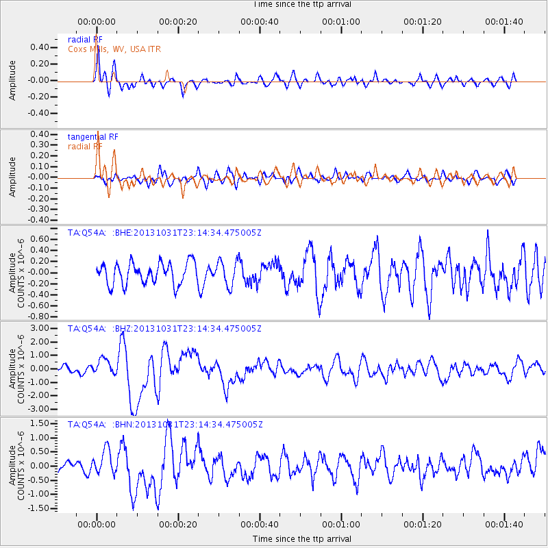
Signal To Noise
| Channel | StoN | STA | LTA |
| TA:Q54A: :BHZ:20131031T23:14:34.475005Z | 2.3831642 | 6.0836214E-7 | 2.5527498E-7 |
| TA:Q54A: :BHN:20131031T23:14:34.475005Z | 2.2505991 | 4.40559E-7 | 1.9575188E-7 |
| TA:Q54A: :BHE:20131031T23:14:34.475005Z | 1.1960517 | 2.2925155E-7 | 1.916736E-7 |
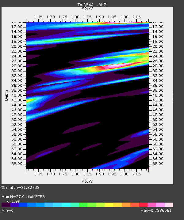
| Arrivals | |
| Ps | 4.4 SECOND |
| PpPs | 13 SECOND |
| PsPs/PpSs | 17 SECOND |

