
R55A Marlinton, WV, USA - Earthquake Result Viewer
| ||||||||||||||||||
| ||||||||||||||||||
| ||||||||||||||||||
|

Signal To Noise
| Channel | StoN | STA | LTA |
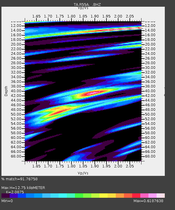
| TA:R55A: :BHZ:20131031T23:14:29.699004Z | 2.8463848 | 6.9707653E-7 | 2.448989E-7 |
| TA:R55A: :BHN:20131031T23:14:29.699004Z | 1.5973036 | 3.245E-7 | 2.0315487E-7 |
| TA:R55A: :BHE:20131031T23:14:29.699004Z | 1.3012223 | 1.7497783E-7 | 1.3447189E-7 |
| Arrivals | |
| Ps | 2.3 SECOND |
| PpPs | 6.2 SECOND |
| PsPs/PpSs | 8.5 SECOND |

