R58A Rapidan, VA, USA - Earthquake Result Viewer
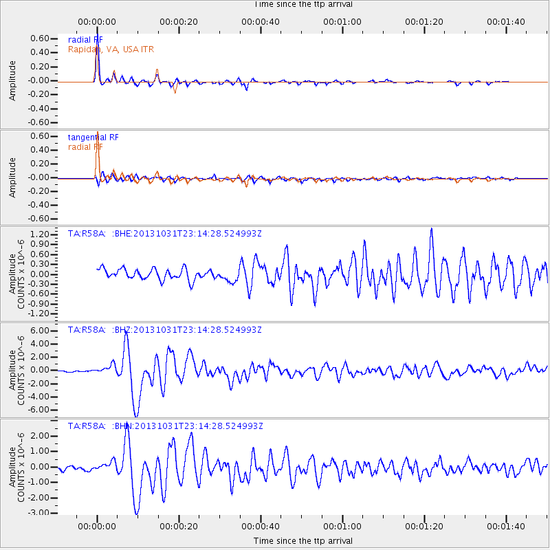
Earthquake location: Near Coast Of Central Chile
Earthquake latitude/longitude: -30.3/-71.5
Earthquake time(UTC): 2013/10/31 (304) 23:03:59 GMT
Earthquake Depth: 27 km
Earthquake Magnitude: 6.6 MWW, 6.4 MWB, 6.5 MWC, 6.6 MWW, 6.6 MI
Earthquake Catalog/Contributor: NEIC PDE/NEIC COMCAT
Network: TA USArray Transportable Network (new EarthScope stations)
Station: R58A Rapidan, VA, USA
Lat/Lon: 38.30 N/78.00 W
Elevation: 184 m
Distance: 68.5 deg
Az: 354.522 deg
Baz: 173.976 deg
Ray Param: 0.05622346
Estimated Moho Depth: 34.75 km
Estimated Crust Vp/Vs: 1.69
Assumed Crust Vp: 6.159 km/s
Estimated Crust Vs: 3.644 km/s
Estimated Crust Poisson's Ratio: 0.23
Radial Match: 96.43263 %
Radial Bump: 231
Transverse Match: 77.8284 %
Transverse Bump: 400
SOD ConfigId: 626651
Insert Time: 2014-04-19 09:20:46.726 +0000
GWidth: 2.5
Max Bumps: 400
Tol: 0.001

Signal To Noise

ChannelStoNSTALTA
TA:R58A: :BHZ:20131031T23:14:28.524993Z4.0190657.0981946E-71.7661309E-7
TA:R58A: :BHN:20131031T23:14:28.524993Z2.20978952.9491517E-71.3345849E-7
TA:R58A: :BHE:20131031T23:14:28.524993Z1.11348411.8320203E-71.6453043E-7
Arrivals
Ps4.0 SECOND
PpPs15 SECOND
PsPs/PpSs19 SECOND