R58B Mineral, VA, USA - Earthquake Result Viewer
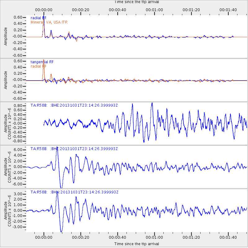
Earthquake location: Near Coast Of Central Chile
Earthquake latitude/longitude: -30.3/-71.5
Earthquake time(UTC): 2013/10/31 (304) 23:03:59 GMT
Earthquake Depth: 27 km
Earthquake Magnitude: 6.6 MWW, 6.4 MWB, 6.5 MWC, 6.6 MWW, 6.6 MI
Earthquake Catalog/Contributor: NEIC PDE/NEIC COMCAT
Network: TA USArray Transportable Network (new EarthScope stations)
Station: R58B Mineral, VA, USA
Lat/Lon: 37.96 N/77.88 W
Elevation: 116 m
Distance: 68.2 deg
Az: 354.59 deg
Baz: 174.078 deg
Ray Param: 0.056447815
Estimated Moho Depth: 33.5 km
Estimated Crust Vp/Vs: 1.76
Assumed Crust Vp: 6.565 km/s
Estimated Crust Vs: 3.725 km/s
Estimated Crust Poisson's Ratio: 0.26
Radial Match: 97.06664 %
Radial Bump: 301
Transverse Match: 87.08932 %
Transverse Bump: 400
SOD ConfigId: 626651
Insert Time: 2014-04-19 09:20:48.671 +0000
GWidth: 2.5
Max Bumps: 400
Tol: 0.001

Signal To Noise

ChannelStoNSTALTA
TA:R58B: :BHZ:20131031T23:14:26.399993Z5.2700998.32798E-71.580232E-7
TA:R58B: :BHN:20131031T23:14:26.399993Z2.47109943.592733E-71.4539006E-7
TA:R58B: :BHE:20131031T23:14:26.399993Z1.68606821.7518458E-71.0390125E-7
Arrivals
Ps4.1 SECOND
PpPs14 SECOND
PsPs/PpSs18 SECOND