S50A Richmond, KY, USA - Earthquake Result Viewer
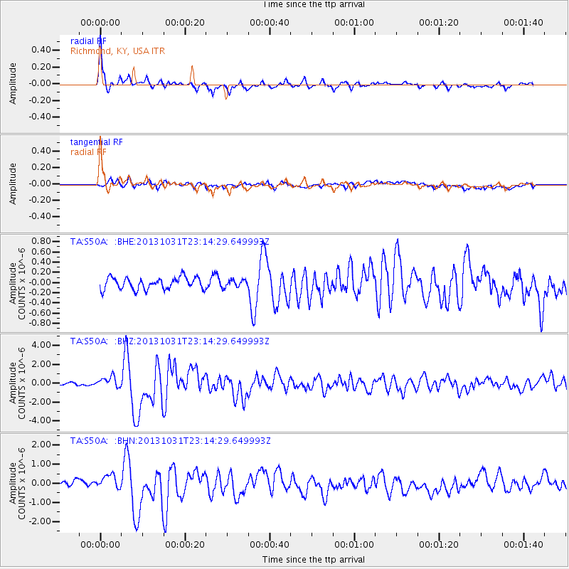
Earthquake location: Near Coast Of Central Chile
Earthquake latitude/longitude: -30.3/-71.5
Earthquake time(UTC): 2013/10/31 (304) 23:03:59 GMT
Earthquake Depth: 27 km
Earthquake Magnitude: 6.6 MWW, 6.4 MWB, 6.5 MWC, 6.6 MWW, 6.6 MI
Earthquake Catalog/Contributor: NEIC PDE/NEIC COMCAT
Network: TA USArray Transportable Network (new EarthScope stations)
Station: S50A Richmond, KY, USA
Lat/Lon: 37.68 N/84.40 W
Elevation: 300 m
Distance: 68.7 deg
Az: 349.057 deg
Baz: 168.057 deg
Ray Param: 0.056106634
Estimated Moho Depth: 59.25 km
Estimated Crust Vp/Vs: 1.72
Assumed Crust Vp: 6.476 km/s
Estimated Crust Vs: 3.765 km/s
Estimated Crust Poisson's Ratio: 0.24
Radial Match: 90.44883 %
Radial Bump: 400
Transverse Match: 76.66209 %
Transverse Bump: 400
SOD ConfigId: 626651
Insert Time: 2014-04-19 09:21:06.458 +0000
GWidth: 2.5
Max Bumps: 400
Tol: 0.001

Signal To Noise

ChannelStoNSTALTA
TA:S50A: :BHZ:20131031T23:14:29.649993Z4.01271726.047987E-71.5072048E-7
TA:S50A: :BHN:20131031T23:14:29.649993Z2.0927173.9707427E-71.8974102E-7
TA:S50A: :BHE:20131031T23:14:29.649993Z0.62869517.2247516E-81.1491663E-7
Arrivals
Ps6.9 SECOND
PpPs24 SECOND
PsPs/PpSs31 SECOND