
S51A Beattyville, KY, USA - Earthquake Result Viewer
| ||||||||||||||||||
| ||||||||||||||||||
| ||||||||||||||||||
|
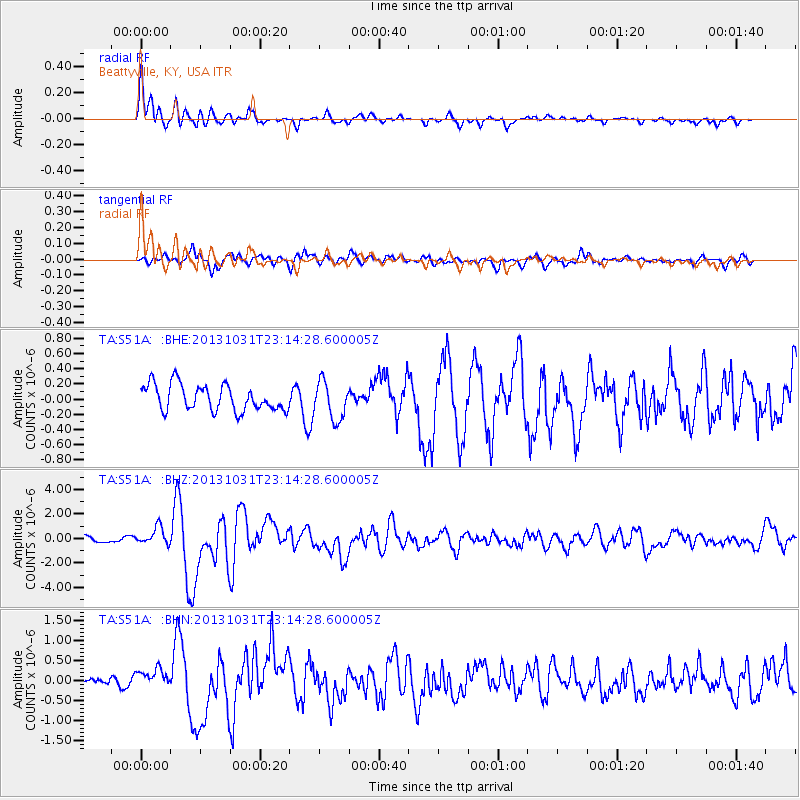
Signal To Noise
| Channel | StoN | STA | LTA |
| TA:S51A: :BHZ:20131031T23:14:28.600005Z | 3.8422217 | 7.243122E-7 | 1.8851391E-7 |
| TA:S51A: :BHN:20131031T23:14:28.600005Z | 2.1337774 | 2.6156943E-7 | 1.2258515E-7 |
| TA:S51A: :BHE:20131031T23:14:28.600005Z | 1.4617983 | 2.4828162E-7 | 1.698467E-7 |
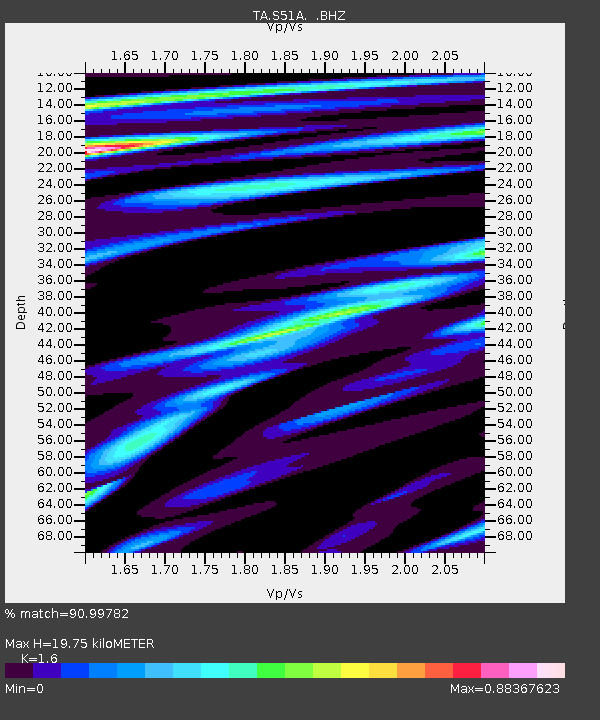
| Arrivals | |
| Ps | 1.9 SECOND |
| PpPs | 7.6 SECOND |
| PsPs/PpSs | 9.5 SECOND |

