SFIN Lafayette, IN, USA - Earthquake Result Viewer
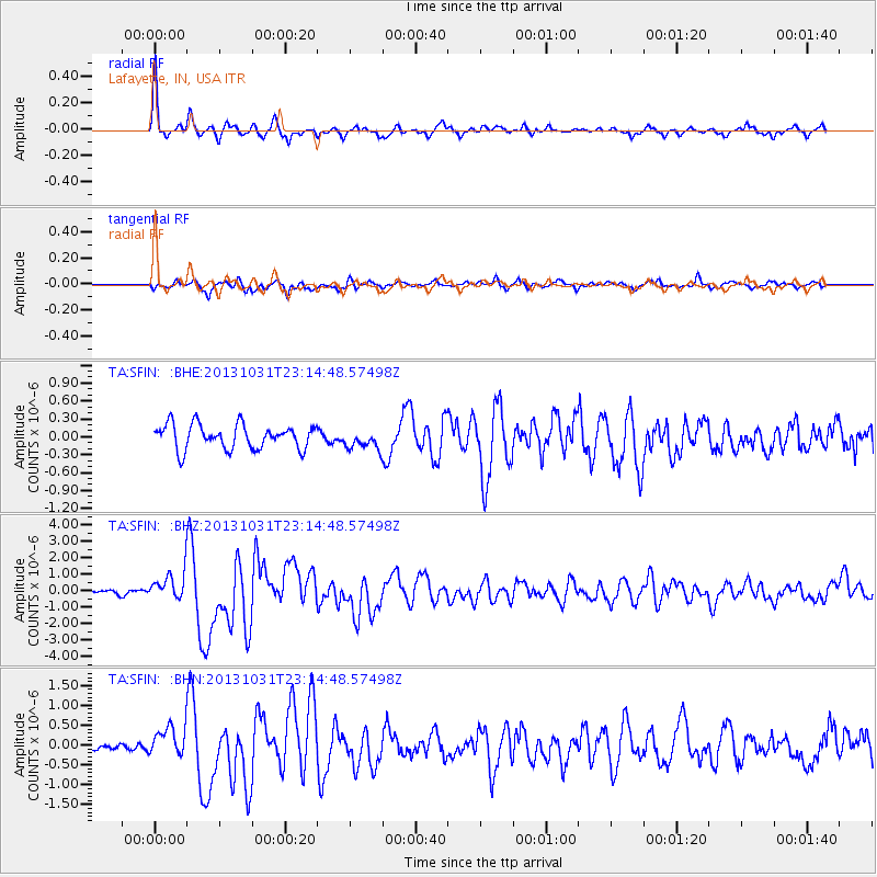
Earthquake location: Near Coast Of Central Chile
Earthquake latitude/longitude: -30.3/-71.5
Earthquake time(UTC): 2013/10/31 (304) 23:03:59 GMT
Earthquake Depth: 27 km
Earthquake Magnitude: 6.6 MWW, 6.4 MWB, 6.5 MWC, 6.6 MWW, 6.6 MI
Earthquake Catalog/Contributor: NEIC PDE/NEIC COMCAT
Network: TA USArray Transportable Network (new EarthScope stations)
Station: SFIN Lafayette, IN, USA
Lat/Lon: 40.38 N/87.10 W
Elevation: 165 m
Distance: 71.8 deg
Az: 347.53 deg
Baz: 165.848 deg
Ray Param: 0.05406127
Estimated Moho Depth: 33.75 km
Estimated Crust Vp/Vs: 2.02
Assumed Crust Vp: 6.498 km/s
Estimated Crust Vs: 3.217 km/s
Estimated Crust Poisson's Ratio: 0.34
Radial Match: 90.78827 %
Radial Bump: 335
Transverse Match: 72.67971 %
Transverse Bump: 400
SOD ConfigId: 626651
Insert Time: 2014-04-19 09:21:32.498 +0000
GWidth: 2.5
Max Bumps: 400
Tol: 0.001

Signal To Noise

ChannelStoNSTALTA
TA:SFIN: :BHZ:20131031T23:14:48.57498Z3.52096948.442456E-72.3977648E-7
TA:SFIN: :BHN:20131031T23:14:48.57498Z2.97377513.7866707E-71.2733548E-7
TA:SFIN: :BHE:20131031T23:14:48.57498Z0.809449851.643457E-72.0303382E-7
Arrivals
Ps5.5 SECOND
PpPs15 SECOND
PsPs/PpSs21 SECOND