T25A Trinidad, CO, USA - Earthquake Result Viewer
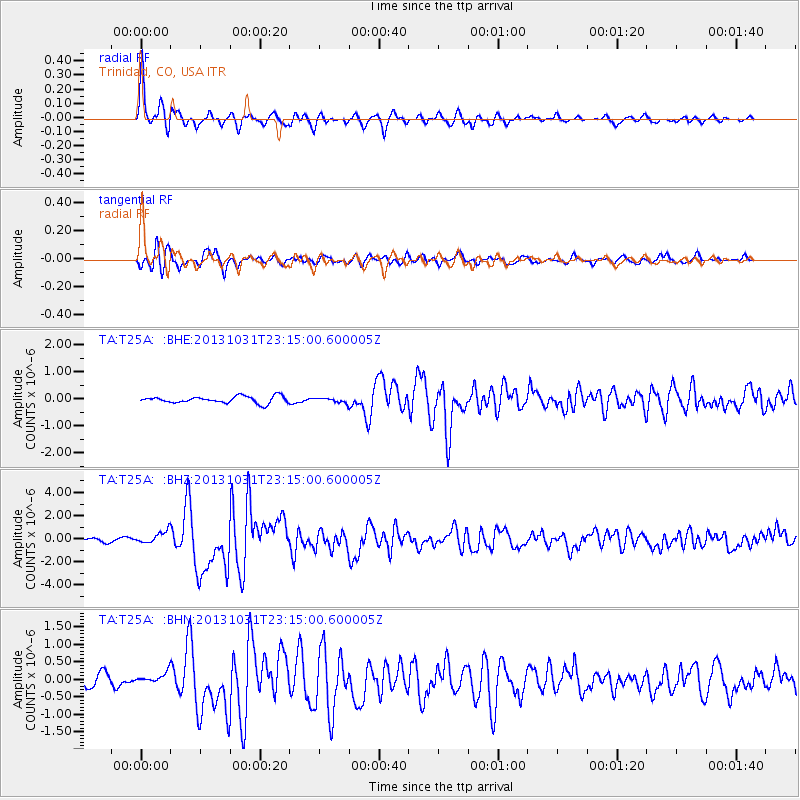
Earthquake location: Near Coast Of Central Chile
Earthquake latitude/longitude: -30.3/-71.5
Earthquake time(UTC): 2013/10/31 (304) 23:03:59 GMT
Earthquake Depth: 27 km
Earthquake Magnitude: 6.6 MWW, 6.4 MWB, 6.5 MWC, 6.6 MWW, 6.6 MI
Earthquake Catalog/Contributor: NEIC PDE/NEIC COMCAT
Network: TA USArray Transportable Network (new EarthScope stations)
Station: T25A Trinidad, CO, USA
Lat/Lon: 37.14 N/104.41 W
Elevation: 2017 m
Distance: 73.8 deg
Az: 333.138 deg
Baz: 150.722 deg
Ray Param: 0.05271516
Estimated Moho Depth: 53.75 km
Estimated Crust Vp/Vs: 1.75
Assumed Crust Vp: 6.316 km/s
Estimated Crust Vs: 3.619 km/s
Estimated Crust Poisson's Ratio: 0.26
Radial Match: 94.891945 %
Radial Bump: 358
Transverse Match: 82.76126 %
Transverse Bump: 400
SOD ConfigId: 626651
Insert Time: 2014-04-19 09:21:38.876 +0000
GWidth: 2.5
Max Bumps: 400
Tol: 0.001

Signal To Noise

ChannelStoNSTALTA
TA:T25A: :BHZ:20131031T23:15:00.600005Z4.63559345.444321E-71.1744604E-7
TA:T25A: :BHN:20131031T23:15:00.600005Z1.05410041.6287078E-71.5451164E-7
TA:T25A: :BHE:20131031T23:15:00.600005Z0.681610948.4759186E-81.2435127E-7
Arrivals
Ps6.6 SECOND
PpPs23 SECOND
PsPs/PpSs29 SECOND