T53A Wise, VA, USA - Earthquake Result Viewer
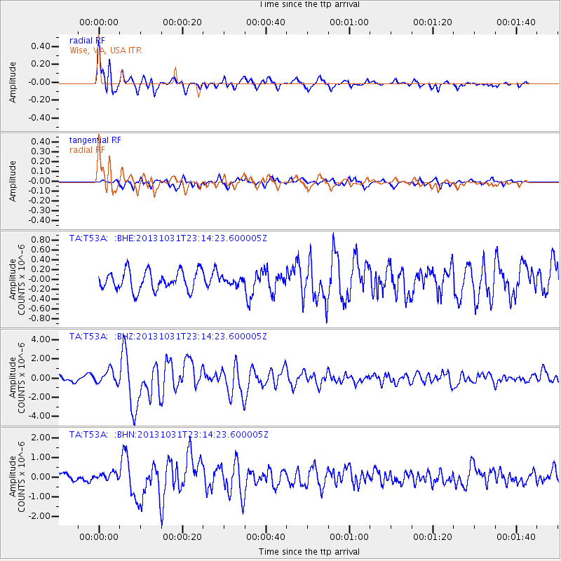
Earthquake location: Near Coast Of Central Chile
Earthquake latitude/longitude: -30.3/-71.5
Earthquake time(UTC): 2013/10/31 (304) 23:03:59 GMT
Earthquake Depth: 27 km
Earthquake Magnitude: 6.6 MWW, 6.4 MWB, 6.5 MWC, 6.6 MWW, 6.6 MI
Earthquake Catalog/Contributor: NEIC PDE/NEIC COMCAT
Network: TA USArray Transportable Network (new EarthScope stations)
Station: T53A Wise, VA, USA
Lat/Lon: 36.98 N/82.54 W
Elevation: 818 m
Distance: 67.7 deg
Az: 350.484 deg
Baz: 169.713 deg
Ray Param: 0.056739293
Estimated Moho Depth: 28.0 km
Estimated Crust Vp/Vs: 1.60
Assumed Crust Vp: 6.476 km/s
Estimated Crust Vs: 4.047 km/s
Estimated Crust Poisson's Ratio: 0.18
Radial Match: 90.592735 %
Radial Bump: 400
Transverse Match: 75.84628 %
Transverse Bump: 400
SOD ConfigId: 626651
Insert Time: 2014-04-19 09:21:54.957 +0000
GWidth: 2.5
Max Bumps: 400
Tol: 0.001

Signal To Noise

ChannelStoNSTALTA
TA:T53A: :BHZ:20131031T23:14:23.600005Z3.183547.0392446E-72.2111375E-7
TA:T53A: :BHN:20131031T23:14:23.600005Z0.9328771.7589784E-71.8855415E-7
TA:T53A: :BHE:20131031T23:14:23.600005Z0.338322466.656565E-81.9675208E-7
Arrivals
Ps2.7 SECOND
PpPs11 SECOND
PsPs/PpSs13 SECOND