
T54A Tazewell, VA, USA - Earthquake Result Viewer
| ||||||||||||||||||
| ||||||||||||||||||
| ||||||||||||||||||
|
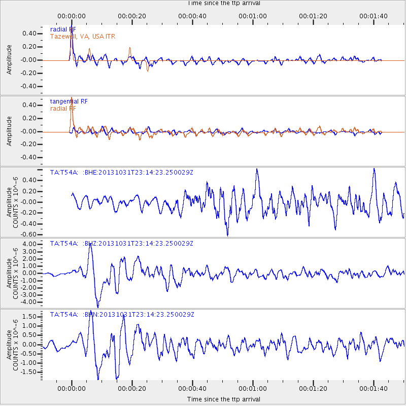
Signal To Noise
| Channel | StoN | STA | LTA |
| TA:T54A: :BHZ:20131031T23:14:23.250029Z | 3.432217 | 4.781483E-7 | 1.393118E-7 |
| TA:T54A: :BHN:20131031T23:14:23.250029Z | 1.5937768 | 3.2737526E-7 | 2.0540845E-7 |
| TA:T54A: :BHE:20131031T23:14:23.250029Z | 1.4782631 | 1.2598247E-7 | 8.5223306E-8 |
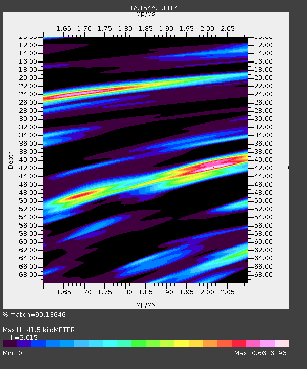
| Arrivals | |
| Ps | 7.1 SECOND |
| PpPs | 20 SECOND |
| PsPs/PpSs | 27 SECOND |

