T56A Rocky Mt, VA, USA - Earthquake Result Viewer
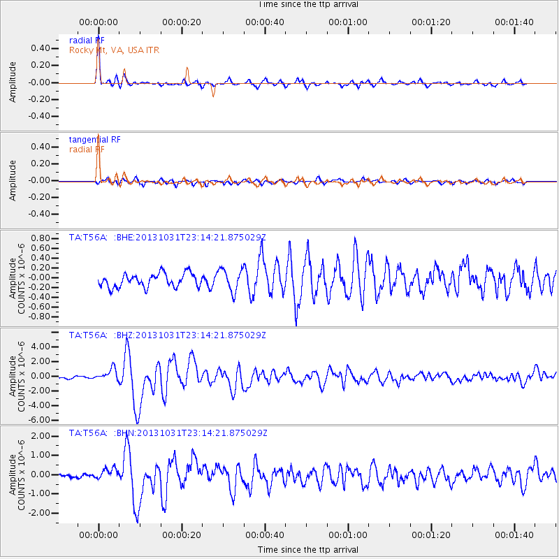
Earthquake location: Near Coast Of Central Chile
Earthquake latitude/longitude: -30.3/-71.5
Earthquake time(UTC): 2013/10/31 (304) 23:03:59 GMT
Earthquake Depth: 27 km
Earthquake Magnitude: 6.6 MWW, 6.4 MWB, 6.5 MWC, 6.6 MWW, 6.6 MI
Earthquake Catalog/Contributor: NEIC PDE/NEIC COMCAT
Network: TA USArray Transportable Network (new EarthScope stations)
Station: T56A Rocky Mt, VA, USA
Lat/Lon: 37.03 N/80.03 W
Elevation: 387 m
Distance: 67.4 deg
Az: 352.633 deg
Baz: 172.034 deg
Ray Param: 0.05691655
Estimated Moho Depth: 57.0 km
Estimated Crust Vp/Vs: 1.65
Assumed Crust Vp: 6.159 km/s
Estimated Crust Vs: 3.727 km/s
Estimated Crust Poisson's Ratio: 0.21
Radial Match: 94.10422 %
Radial Bump: 345
Transverse Match: 77.64824 %
Transverse Bump: 400
SOD ConfigId: 626651
Insert Time: 2014-04-19 09:22:04.609 +0000
GWidth: 2.5
Max Bumps: 400
Tol: 0.001

Signal To Noise

ChannelStoNSTALTA
TA:T56A: :BHZ:20131031T23:14:21.875029Z4.85856258.422274E-71.7334911E-7
TA:T56A: :BHN:20131031T23:14:21.875029Z2.45332723.28387E-71.3385372E-7
TA:T56A: :BHE:20131031T23:14:21.875029Z1.6932592.30839E-71.3632823E-7
Arrivals
Ps6.3 SECOND
PpPs24 SECOND
PsPs/PpSs30 SECOND