T57A Hurt, VA, USA - Earthquake Result Viewer
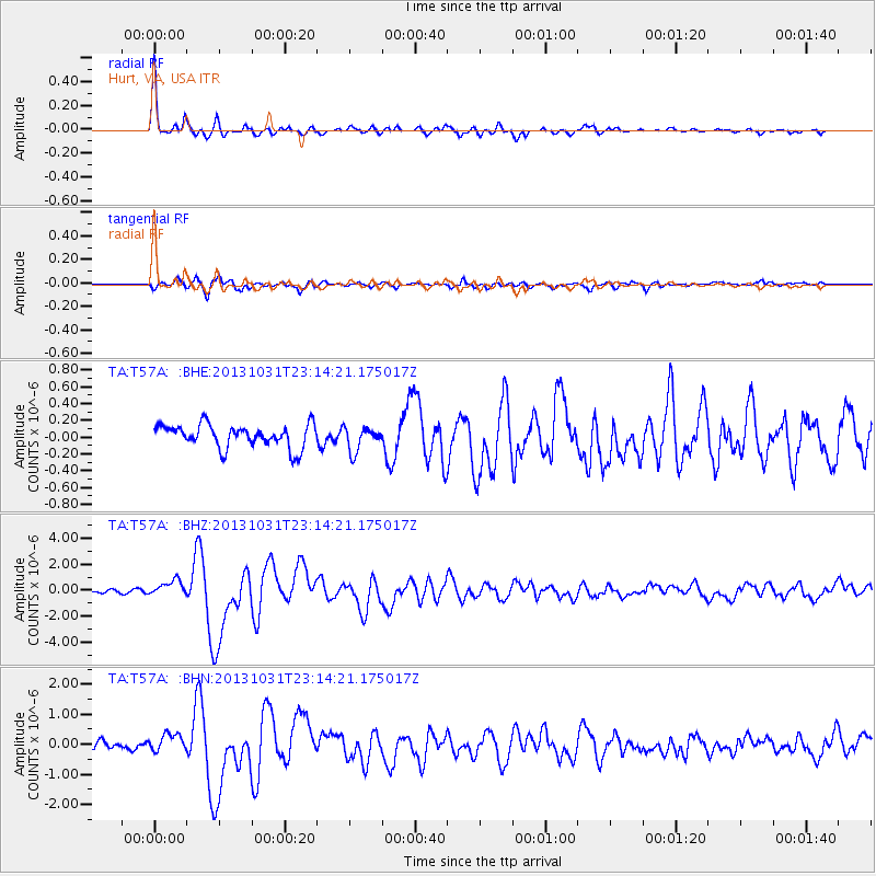
Earthquake location: Near Coast Of Central Chile
Earthquake latitude/longitude: -30.3/-71.5
Earthquake time(UTC): 2013/10/31 (304) 23:03:59 GMT
Earthquake Depth: 27 km
Earthquake Magnitude: 6.6 MWW, 6.4 MWB, 6.5 MWC, 6.6 MWW, 6.6 MI
Earthquake Catalog/Contributor: NEIC PDE/NEIC COMCAT
Network: TA USArray Transportable Network (new EarthScope stations)
Station: T57A Hurt, VA, USA
Lat/Lon: 37.00 N/79.25 W
Elevation: 230 m
Distance: 67.3 deg
Az: 353.296 deg
Baz: 172.755 deg
Ray Param: 0.056989845
Estimated Moho Depth: 22.25 km
Estimated Crust Vp/Vs: 1.89
Assumed Crust Vp: 6.419 km/s
Estimated Crust Vs: 3.401 km/s
Estimated Crust Poisson's Ratio: 0.30
Radial Match: 95.46983 %
Radial Bump: 360
Transverse Match: 81.48021 %
Transverse Bump: 400
SOD ConfigId: 626651
Insert Time: 2014-04-19 09:22:05.340 +0000
GWidth: 2.5
Max Bumps: 400
Tol: 0.001

Signal To Noise

ChannelStoNSTALTA
TA:T57A: :BHZ:20131031T23:14:21.175017Z3.61384536.0858696E-71.6840426E-7
TA:T57A: :BHN:20131031T23:14:21.175017Z2.50241072.9915705E-71.1954755E-7
TA:T57A: :BHE:20131031T23:14:21.175017Z1.07049451.461751E-71.3654912E-7
Arrivals
Ps3.2 SECOND
PpPs9.6 SECOND
PsPs/PpSs13 SECOND