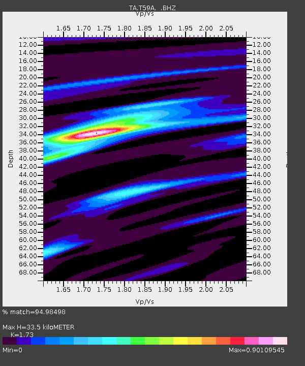
T59A Double 'B' Farms, VA, USA - Earthquake Result Viewer
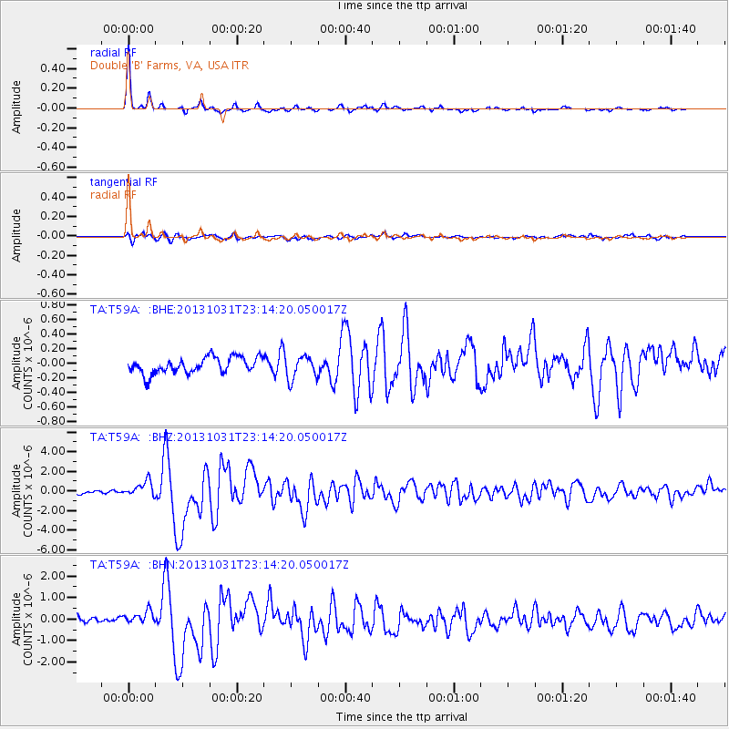
Earthquake location: Near Coast Of Central Chile
Earthquake latitude/longitude: -30.3/-71.5
Earthquake time(UTC): 2013/10/31 (304) 23:03:59 GMT
Earthquake Depth: 27 km
Earthquake Magnitude: 6.6 MWW, 6.4 MWB, 6.5 MWC, 6.6 MWW, 6.6 MI
Earthquake Catalog/Contributor: NEIC PDE/NEIC COMCAT
Network: TA USArray Transportable Network (new EarthScope stations)
Station: T59A Double 'B' Farms, VA, USA
Lat/Lon: 36.97 N/77.55 W
Elevation: 63 m
Distance: 67.2 deg
Az: 354.76 deg
Baz: 174.339 deg
Ray Param: 0.057106726
Estimated Moho Depth: 33.5 km
Estimated Crust Vp/Vs: 1.73
Assumed Crust Vp: 6.565 km/s
Estimated Crust Vs: 3.795 km/s
Estimated Crust Poisson's Ratio: 0.25
Radial Match: 94.98498 %
Radial Bump: 227
Transverse Match: 81.19052 %
Transverse Bump: 400
SOD ConfigId: 626651
Insert Time: 2014-04-19 09:22:10.333 +0000
GWidth: 2.5
Max Bumps: 400
Tol: 0.001

Signal To Noise

ChannelStoNSTALTA
TA:T59A: :BHZ:20131031T23:14:20.050017Z4.1605268.0038774E-71.9237658E-7
TA:T59A: :BHN:20131031T23:14:20.050017Z2.19683073.3218961E-71.5121311E-7
TA:T59A: :BHE:20131031T23:14:20.050017Z1.44747291.5915111E-71.0995101E-7
Arrivals
Ps3.9 SECOND
PpPs13 SECOND
PsPs/PpSs17 SECOND