
TUL1 Leonard, OK, USA - Earthquake Result Viewer
| ||||||||||||||||||
| ||||||||||||||||||
| ||||||||||||||||||
|
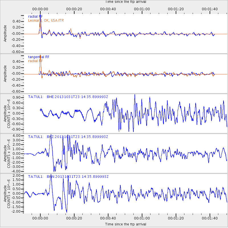
Signal To Noise
| Channel | StoN | STA | LTA |
| TA:TUL1: :BHZ:20131031T23:14:35.899993Z | 4.9136815 | 4.877666E-7 | 9.926704E-8 |
| TA:TUL1: :BHN:20131031T23:14:35.899993Z | 1.1047114 | 1.7409201E-7 | 1.5759048E-7 |
| TA:TUL1: :BHE:20131031T23:14:35.899993Z | 1.9936861 | 2.583904E-7 | 1.2960436E-7 |
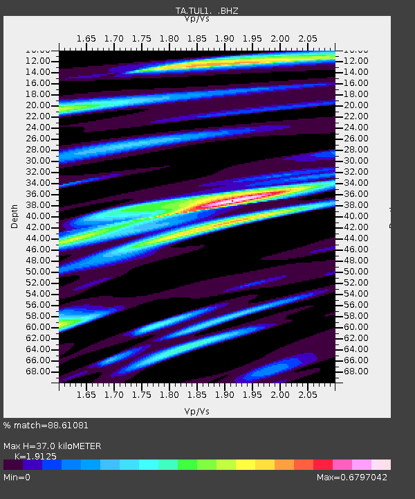
| Arrivals | |
| Ps | 5.4 SECOND |
| PpPs | 16 SECOND |
| PsPs/PpSs | 21 SECOND |

