U53A Fall Branch, TN, USA - Earthquake Result Viewer
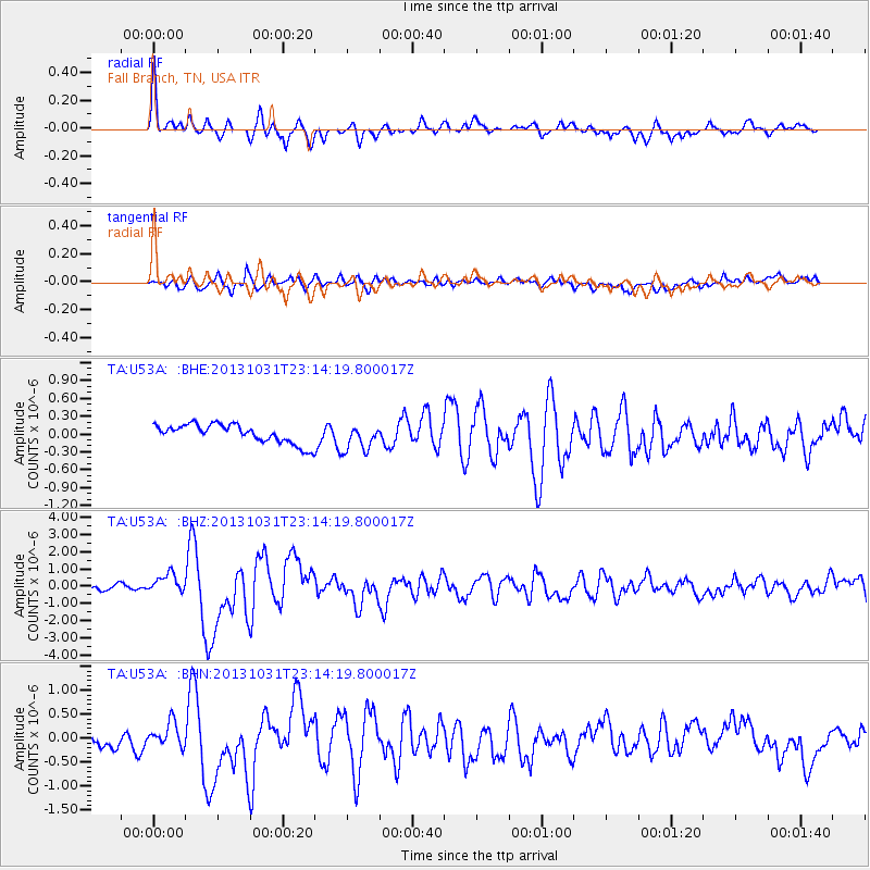
Earthquake location: Near Coast Of Central Chile
Earthquake latitude/longitude: -30.3/-71.5
Earthquake time(UTC): 2013/10/31 (304) 23:03:59 GMT
Earthquake Depth: 27 km
Earthquake Magnitude: 6.6 MWW, 6.4 MWB, 6.5 MWC, 6.6 MWW, 6.6 MI
Earthquake Catalog/Contributor: NEIC PDE/NEIC COMCAT
Network: TA USArray Transportable Network (new EarthScope stations)
Station: U53A Fall Branch, TN, USA
Lat/Lon: 36.36 N/82.58 W
Elevation: 559 m
Distance: 67.1 deg
Az: 350.329 deg
Baz: 169.629 deg
Ray Param: 0.05713057
Estimated Moho Depth: 43.0 km
Estimated Crust Vp/Vs: 1.60
Assumed Crust Vp: 6.476 km/s
Estimated Crust Vs: 4.047 km/s
Estimated Crust Poisson's Ratio: 0.18
Radial Match: 86.95527 %
Radial Bump: 400
Transverse Match: 72.80587 %
Transverse Bump: 400
SOD ConfigId: 626651
Insert Time: 2014-04-19 09:22:37.076 +0000
GWidth: 2.5
Max Bumps: 400
Tol: 0.001

Signal To Noise

ChannelStoNSTALTA
TA:U53A: :BHZ:20131031T23:14:19.800017Z3.0603345.672894E-71.8536846E-7
TA:U53A: :BHN:20131031T23:14:19.800017Z1.58189492.6215636E-71.65723E-7
TA:U53A: :BHE:20131031T23:14:19.800017Z1.39866082.2185421E-71.5861903E-7
Arrivals
Ps4.2 SECOND
PpPs17 SECOND
PsPs/PpSs21 SECOND