U57A Blanch, NC, USA - Earthquake Result Viewer
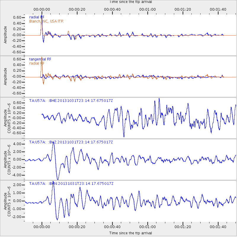
Earthquake location: Near Coast Of Central Chile
Earthquake latitude/longitude: -30.3/-71.5
Earthquake time(UTC): 2013/10/31 (304) 23:03:59 GMT
Earthquake Depth: 27 km
Earthquake Magnitude: 6.6 MWW, 6.4 MWB, 6.5 MWC, 6.6 MWW, 6.6 MI
Earthquake Catalog/Contributor: NEIC PDE/NEIC COMCAT
Network: TA USArray Transportable Network (new EarthScope stations)
Station: U57A Blanch, NC, USA
Lat/Lon: 36.43 N/79.34 W
Elevation: 178 m
Distance: 66.8 deg
Az: 353.147 deg
Baz: 172.647 deg
Ray Param: 0.057352576
Estimated Moho Depth: 38.5 km
Estimated Crust Vp/Vs: 1.61
Assumed Crust Vp: 6.419 km/s
Estimated Crust Vs: 3.987 km/s
Estimated Crust Poisson's Ratio: 0.19
Radial Match: 91.49296 %
Radial Bump: 343
Transverse Match: 66.54163 %
Transverse Bump: 400
SOD ConfigId: 626651
Insert Time: 2014-04-19 09:22:46.549 +0000
GWidth: 2.5
Max Bumps: 400
Tol: 0.001

Signal To Noise

ChannelStoNSTALTA
TA:U57A: :BHZ:20131031T23:14:17.675017Z4.2603936.3521395E-71.490975E-7
TA:U57A: :BHN:20131031T23:14:17.675017Z1.22125262.6875423E-72.2006442E-7
TA:U57A: :BHE:20131031T23:14:17.675017Z1.91901361.798395E-79.3714554E-8
Arrivals
Ps3.8 SECOND
PpPs15 SECOND
PsPs/PpSs19 SECOND